
A Short Introduction
First off, I never intended to hike the John Muir Trail in eight days. The dream to hike the trail first began a few years ago, after my then partner and I obtained a permit, only to be turned around by an abnormally deep late season Sierra Mountain snow-pack. At that time, I hadn’t hiked longer than three days, so the JMT was my breakout through-hike foyer, probably spanning the typical four weeks with three full stops for resupply. Since then, I’ve spent many weeks backpacking across various parts of the United States and completed the 2,189 mile Appalachian Trail in 2017. Eleven months since hiking my final mile on the AT, I scored an eleven day vacation opportunity and planned to make the most it. I had spent the last year in the Tetons, mostly backcountry skiing, mountaineering and trail running. Unfortunately, because of an incredibly hectic work schedule I was only able to manage two over-night backpacking trips the entire summer. Having spent virtually half of 2017 hiking from Georgia to Maine, I was beginning to feel a little confined to society. I dreamed of what I could do with eleven days, trying to glutinously maximize the amount of time I could spend, new places I could see and distance I could travel in the backcountry. As I sifted through my bulging collection of guidebooks and maps, the familiar cover of “John Muir Trail: The Essential Guide to Hiking America’s Most Beautiful Trail” caught my eye. I played with the idea for a few days, questioning the feasibility of hiking 212 miles and climbing 47,000 vertical feet in an eight day span. To my advantage, I had spent the entire summer training for an ultra-marathon, (which never materialized due to injury) so I had a great fitness base. However, physical challenges aside, October marked the beginning of winter in the Sierra Range. Subzero temperatures, sporadic snowstorms and the closure of National Parks, mountain roads and other hiker services were either guaranteed or knocking on the door. Nevertheless, dreams of hiking the JMT flooded my brain with a ferocious and tenacious nagging. I decided to purchase a permit, albeit impulsively, less than one week before my October 9th start date.
Preparation
My three main concerns when planning for the JMT were time, weather and physical health. Hiking 27.5 miles per day through the Sierra Range was not trivial. I sifted the internet for accounts of JMT hikes in similar times. I found only four. The first was an ultra runner who completed the trail in under four days, aided by a full support team. The second was an older gentleman who wrote a book about his nine-day through hike in the middle of summer. He re-supplied four separate times to keep his pack weight very low, and battled virtually no weather. The third was an accomplished ultra-running couple who set out to attempt a seven day through hike, only to fall short with extreme fatigue and finish on day ten. Lastly, a famous “fast-packer” Andrew Skurka completed the trek in under seven days, but again, resupplied twice and traveled with a pacer. Each one of these four attempts occurred between June and August, when snowpack, rainstorms and cold temperatures aren’t of concearn. I do not list these accomplishments to discredit anyone, but merely to illustrate the thoughts bouncing through my head as I wrapped my mind around the beast to come.
While the range was clear of snow when I secured my permit, the nights were dipping well below freezing. I also knew better than to expect a week of clear skies. I tried to imagine covering 28 miles per day, with a full week’s worth of provisions strapped to my back. Each of the four accounts referenced above involved at least two resupply stops, where gear was picked up at various points along the trail. This allowed the hikers to travel light, but wouldn’t be an option for me. I wrote a rough daily itinerary. I scanned topographic profiles. I studied geographical aspects of mountain passes to identify potentially troublesome zones. I called every ranger station from Mount Whitney to Lake Tahoe. Even the ranger who booked my permit attempted to dissuade me, stating the obvious danger of attempting a fall season through hike. “All resupply points will be closed. You will be completely alone. You may not see another human for days at a time. If anything happens, you will be on your own… and you have a bum ankle?” Besides the time of year and daily mileage, I was also recovering from partially torn ligaments in my right ankle. I sprained my foot less than one month earlier, finishing a solo of Wyoming’s finest Grand Teton. I went to the hospital and rehabbed diligently, but I was still far weaker than I’d been all summer. I knew running with a forty pound pack was off the table, but I figured I could sustain a fast-paced stride with enough Ibuprofen. My plan was to “walk 25 percent slower, but 25 percent longer.” I hoped the repetitive motion would strengthen my ankle, in the same way my stress fracture healed after 740 miles on the Appalachian Trail. To my advantage, there are a handful of road crossings in the first fifty miles south of Yosemite, so in the worst case scenario I had an escape option.
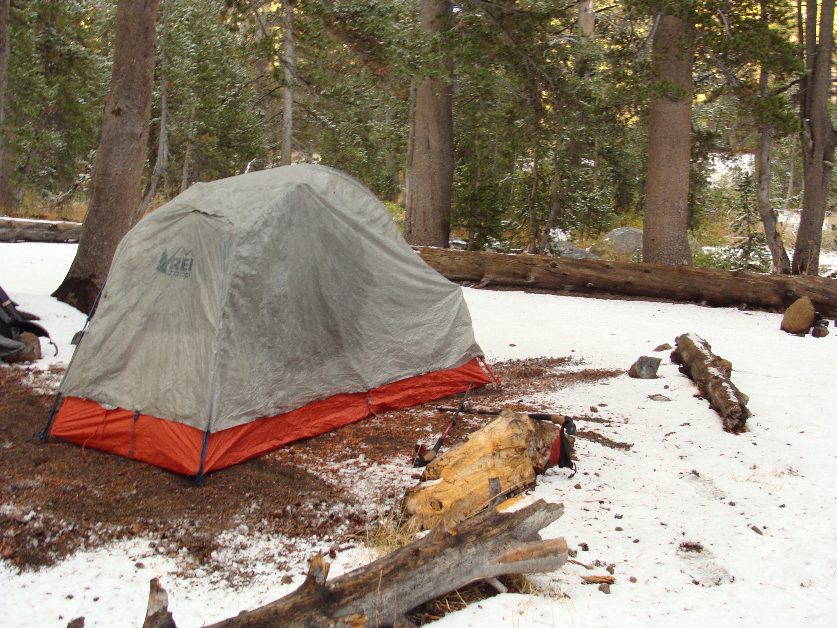
In theory the plan was simple. 7 nights, 8 days. 27.5 miles per day. Living in Teton Valley, I was able to assemble a nearly perfect ultralight backpacking kit with my own gear and a few additions from likeminded friends. I would carry only the barest of bare essentials. Even a toothbrush and toilet paper were out — let alone a fuel stove, proper winter hat or journal. The biggest hassle in packing logistics was cramming 8 days of food into a bear canister, which is required for backcountry travel in the Sierra. I borrowed a 714 cubic inch BearVault canister, the largest volume available on the market. I spent hours in the corner of Barrels and Bins Community Market (my workplace) calculating calories and shoving energy bars into every crack of the canister. After many thwarted attempts and hours of food tetris, I managed to jam the lid shut with 33,000 calories inside. For seven days, that totaled approximately 4,200 calories per day — not ideal, but sufficient. Luckily, I would be spending my first night at a campsite with bear boxes, so I could keep my first and second day’s food loosely secured in my pack. (The only food required to be stored in a bear canister is what you cannot attend to while sleeping) I planned a 100% plant based, whole foods menu — the same way I hiked the Appalachian Trail and dine in the real world. No beef jerky, cheese sticks, pastries or candy bars. I aimed to prove again that a diet free of animal products and processed foods can sustain an endurance athlete in the wilderness. The vast majority of hiker diets rely on the “calories are calories are calories” principle. Snickers bars, Honey Buns and M&Ms… Instant Ramen, smoked sausage links and blocks of cheese…. that’s the way just about every other long distance hiker I’ve met travels. Not me. I not only believe in proper nutrition; I thrive on it. Organic olive oil, whole grain energy bars, lentils, rice, quinoa, sprouted grain tortillas, dark chocolate, homemade trail mix, dried fruit, raw nuts and a small selection of freeze dried vegetables were my JMT staples. One-hundred percent real and whole plant based fuel. When I hoisted my backpack over my shoulder in Yosemite Valley, my pack weight totaled somewhere just south of 40 pounds (with 1.5 liters of water). My final gear and food lists are detailed below:
Gear List
- Backpack: ‘GoLite’ 40L pack, all straps and pouches manually removed
- Tent: REI Quarter Dome (no stakes or footprint)
- Sleeping Bag: Mountain Hardware “Flame” rated to 34 degrees
- Sleeping Pad: Thermarest NeoAir
- Merino wool negative 25 degree sleeping bag liner
- MSR “Soloist” Titanium cook pot
- Esbit emergency “pop stove” with 16 fuel tablets
- MSR Titanium long-neck spork
- Outdoor Research 30 degree down jacket
- Patagonia thermal base layer
- Marmot “minimalist” rain shell
- Over head thermal ski mask
- Darn Tough thick degree wool socks (1 pair, for sleeping)
- Standard weight hiking socks (1 pair, for hiking)
- Colombia zip-off & quick dry hiking pants
- Thermal long underwear
- Exofficio ultralight underwear (1 pair)
- Baseball cap
- Sunglasses
- Petzl Headlamp (300 lumens)
- BearVault BV500 bear canister
- Large trash compactor bag (for use as a pack cover)
- Overnight first aid kit
- Waterproof topographic map
- Medium-sized point and shoot camera
- Orthopedic Ankle Brace
- Black Diamond retractable hiking poles
Food List
Inside the Bear Canister:
- 7 Bobo’s Oat Bars (350–380 calories each)
- 7 ProBar Meal Bars (380–400 calories each)
- 5 cups mixed trail mix (dried fruit and raw nuts) (3000–3500 calories)
- 2 jars natural nut butter (peanut & almond)(3000 calories each)
- 1 cup tamari roasted pumpkin seeds (700 calories)
- 2 cups raw cashew pieces (1400 calories)
- 2 cups of homemade cayenne-maple roasted nuts (1400 calories)
- 6 homemade dehydrated soups in freezer bags (2 split pea, 2 curry lentil and 2 corn chowder, with Harmony House freeze dried vegetables mixed in) (300–350 calories each)
- 3 cups of mixed, parboiled instant grains (brown rice, red rice and quinoa) (600 calories per cup)
- 9 ounces olive oil (240 calories per ounce)
- 4 ounces Sriracha hot sauce
- Half pound dried mango skins (~100 calories per ounce)
- Half pound dried Turkish Figs (~100 calories per ounce)
- 5 bars dark chocolate (Endangered Species and Theo’s Brand, ranging from 75% to 88%) (400 calories each)
- 2 OCHO vegan coconut dark chocolate rolls (210 calories each)
- 8 Trader Joe’s date, hazelnut and cocoa pucks (40 calories each)
- 7 herbal tea bags
- 7 days equivalent instant coffee
Outside the Can (for my first two days, to be carried on my back and stored in bear box at campsite #1):
- 1 “Good-To-Go” vegan brown rice penne with marinara sauce dehydrated meal (~800 calories)
- 1 jar peanut butter (1500 calories)
- 1 pouch of precooked Indian curry (300 calories)
- 1 box Nature’s Path Peanut Butter Granola (~1500 calories)
- 1 ProBar Meal Bar (380 calories)
- 2 Kate’s Real Food Tram Bars (350 calories each)
- 1 large bag of raw almonds (?)
- 1 half empty bag of leftover Mary’s Gone Crackers (?)
- 1 sandwich bag of leftover cooked quinoa from the road (?)
I find it important to note, this is NOT my preferred hiking diet. In an ideal world, I would have a wider array of carbohydrate rich food sources, and at least a few fresh fruits and vegetables. In this instance, having to cram 33,000 calories into a 714 cubic inch can, I had to prioritize fats to maximize caloric density. Originally I made seven bags of oatmeal, my typical trail breakfast, only to find they took up far too much space in the canister. Instead, I chose to eat an oat pastry smothered with a quarter jar of peanut butter for breakfast; over 1000 calories and less volume. Basically, to get the energy I required to sustain 27.5 miles per day, which I estimated at a bare minimum of 4000 calories per day, I had to eat a diet comprised of more than 80% fat. For plant based eaters, that means vegetable oils (olive and coconut), nut butters, coconut, dark chocolate, nuts and seeds are the name of the game. This food strategy intimidated me, as I am used to consuming a carbohydrate rich diet while running, skiing and climbing. I feared my body would not respond well to burning fat as a fuel source, but I had never tried before, so I had no way of knowing. One thing was for certain, I had no choice.
The last crux of the preparation phase was physical. Luckily, this was entirely covered by my ultra-marathon training and mountain lifestyle. The difference between backpacking and trail running preparation is minimal. When the ground was dry I ran an average of 20–30 miles a week on mountainous high altitude single-track. I also spent 2–3 days per week strength training in the gym, focusing on core and leg resistance. Some notable ascents and runs I did that summer are listed below:
- Climb and ski descent of the South Teton (approximate gain 6000’)
- Climb and ski descent of the Middle Teton (approximate gain 6000’)
- Climb and ski descent of Static Peak (approximate gain 5000’)
- Table Mountain speed climb (17 miles, 4500’)
- “Wrun for Wray” Memorial Hill Climb (Grand Targhee Resort, 3.1 miles, 2500’)
- Teton Crest Trail backpacking trip (3 days, 33 miles, 10,000’ gain)
- Big Hole Crest Trail run (~20ish miles, 6000’ net gain)
- Borah Peak speed climb (8 miles, 6000’ gain, tallest peak in Idaho)
- Grand Teton solo speed climb (Class 4, 14 miles, ~7000’ gain, tallest peak in Teton Range)
With the exception of my weakened ankle, I felt I had done all I possibly could to prepare. My food was calculated methodically. My gear was (mostly) field tested and packed. My training was consistent, aggressive and thorough. The only unknown variable was winter weather, but having lived in Idaho for years, I was well versed in the cold and uncomfortable. I took off from Teton Valley on October 6th — a sixteen hour drive away from Yosemite National Park.

Day One (Happy Isles Trailhead to Sunrise High Camp — 13.5 Miles)
…the stillness would become that much more evident. It was a beautiful feeling, a freeing sensation of separation from the material world.
Soon after leaving the Tuolumne Meadows Wilderness Permit Office, I was barreling down CA-120 headed for Yosemite Valley, what Alex Honnold, the world famous rock climber described in his recent documentary as the “most beautiful valley on planet earth.” Home to El Capitan, Half Dome and many other stunning walls of granite, Yosemite Valley is a sight to behold no matter the season. This morning however, a piercingly cold rain slicked the road, and a thick fog blanketed all but the closest of views. The ever beautiful meadows, expansive rock faces and pristine lakes were overtaken by an eerie essence of grey.
After ninety minutesI pulled into a parking space amongst hundreds of cars. I thought the cold temperatures and inclement weather would have driven the tourists away, but I was wrong. Yosemite village, the main gathering place for shopping, food and lodging within the park, was bustling with people of all ages, ethnicity and character. I stopped by the market to grab two last essentials – a trash bag (to pose as an ultralight waterproof backpack cover) and an extra day’s supply of food. Since I planned to spend my first night at Sunrise High Camp complete with a food storage box, I was determined to exploit my advantage and pack out as many calories as I could squeeze into the few inches of space left in my bag. I bought an assortment of ProBars, a pre-cooked Indian curry and a bag of peanut butter granola, and retreated to the car.
The time was just after noon as I completed my final bag check and changed into my hiking apparel. Standing on the corner I recognized a PCT hiker I’d met at the wilderness permit office just hours before. She traveled by the name “SuperFly,” a trail name she earned by “flying” up Mount Whitney. She was a fit-looking German woman in her late twenties, who had spent the last two months hiking 900 miles on the PCT and was returning home to Europe in a matter of days. Yosemite was her final destination, and she was enjoying some of the famous “off-PCT” attractions the park has to offer. Together we drove to the Happy Isles parking lot and parked my car. She was headed the same direction as I, south on the JMT, with the goal of climbing Half Dome. My path would not take me up Half Dome, but our splitting point was over seven miles on the same route. We started off together, something I appreciated to remedy my nerves. My pack felt light and my ankle strong, but I struggled to push an impending feeling of doom from my head. I couldn’t help but hear the ranger’s voice from the Wilderness Permit Office echoing through my head, casting shows of doubt. “You wouldn’t want to make it 60 miles into the wilderness only to find out you weren’t strong enough…” I tried my best to stay positive.
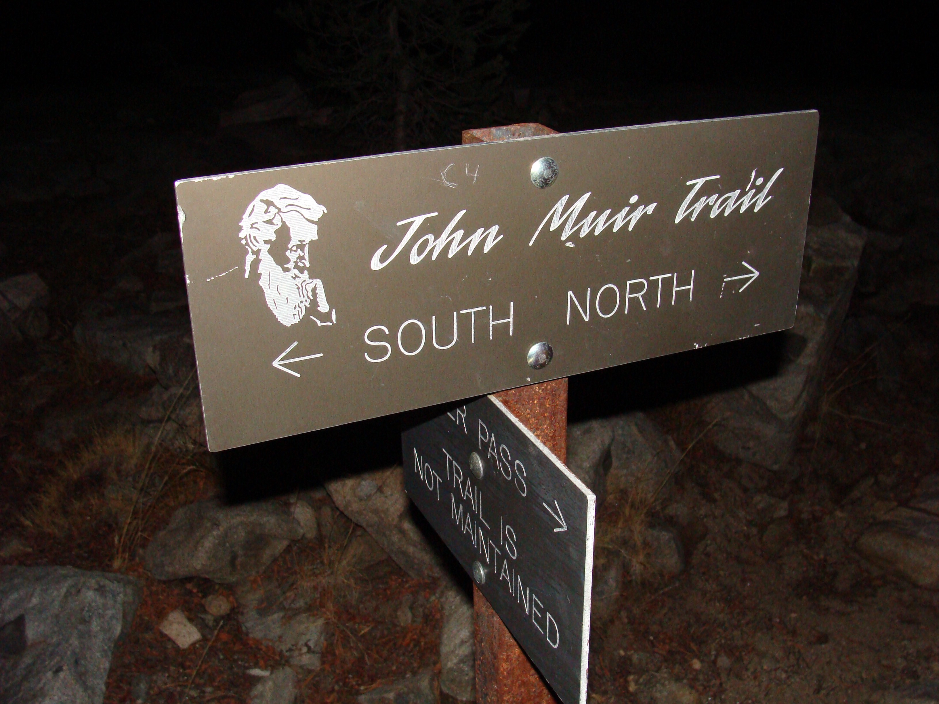
Together, SuperFly and I walked along the paved road for a few minutes until we came to a rusty iron sign with the words “John Muir Trail South — Mount Whitney — 210 miles.” engraved in it. I had climbed this trail before on a much shorter trip many years ago and I remembered it well. I recalled taking a picture with the sign knowing I was only heading seven miles south. I had a longing heart, trying to imagine what it would feel like to hike all the way to Whitney – wanting with every fiber of my body to be hiking all the way to Whitney. Now, I was standing on the doorstep of my dreams. Having completed the Appalachian Trail helped dilute the fear, but I still respected the challenge. I snapped a quick picture, stashed my camera and took a deep pull from my water bottle. The time was roughly 2:00 PM — let the hiking begin.
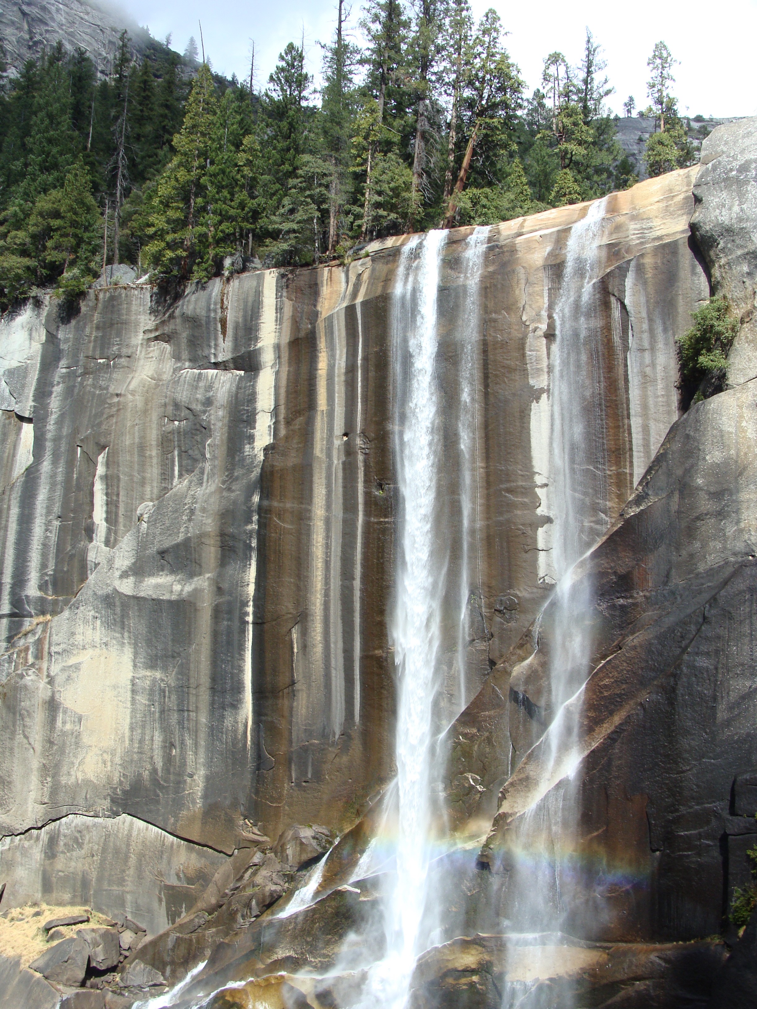
The JMT climbs over five thousand feet directly out of Yosemite Valley, with little to no reprieve until Cathedral Pass at mile 18. The first 4 miles climb directly along the flanks of some of the West Coast’s most impressive waterfalls, including Nevada Falls, the largest in Yosemite. Along with the epic cascading water display, hikers face three consecutive miles of granite slab staircase climbing, with ledges taller than the average person’s knees. With a day pack this stretch is exhausting, but with a backpack it’s almost cruel. Together, SuperFly and I ascended at a steady pace. Sweat poured from every pore of my body, making me second guess my choice to leave a t-shirt in the car. I left it because I was trying to save weight, and thought it wise to hike in my thermal Patagonia base layer instead (because it was October) but in the moment I wished I was naked. The sun had pierced holes in the dreary day, halting the precipitation and providing a beautiful shimmer to the slicked granite walls, along with pore clogging humidity. Birds were chirping and a slight breeze rustled the dense, green trees. Temperature aside, the weather was ideal. Approximately every half hour I stopped for a quick ankle evaluation, a few rolls and stretches. Much to my surprise it felt virtually pain free. I caught my first wind of true confidence after topping out on Nevada Falls, the conclusion of the granite staircase section. SuperFly had long since out-hiked me, so I was left alone walking through Little Yosemite Valley, the area I camped in on my last YNP trip yers before. I had been walking for nearly two hours, and felt excellent about my progress. Another three miles would lead past the trail junction for Half Dome, the point of return for the vast majority of day hikers. South of this point, I would be truly on my own — alone in the woods.

Having gained a few thousand feet, the warm breeze took a more sinister turn. The afternoon grew dark as heavy clouds overlapped the sun once again. I was still moving steadily come 5:00 PM when the first hints of rain began to trickle from the sky. Three hours into my adventure, I was well overdue for a snack, and decided to seek refuge beneath an overturned oak. I cracked open the box of granola I bought from the Yosemite market and poured a steady stream into my mouth. The rain began to hit harder, and as I lay in the dirt beneath the tree stump I became increasingly cold. The light was fading from the sky and having hiked only eight miles, I still had seven remaining. I tried to stay positive, but being pressed for daylight, lying in a crawl space barely fit for a marmot and already facing hypothermic rain on day one, I was emotionally strained. I used the downtime to filter water from a nearby stream and fix the garbage bag over my pack. Luckily, the storm passed as quickly as it came, and with my raincoat and headlamp on I slipped out into the moist and drizzly evening with intent. “You cannot turn back now.” I told myself. “It’s only seven miles. You’ve hiked 2,200 miles… you can handle seven.”
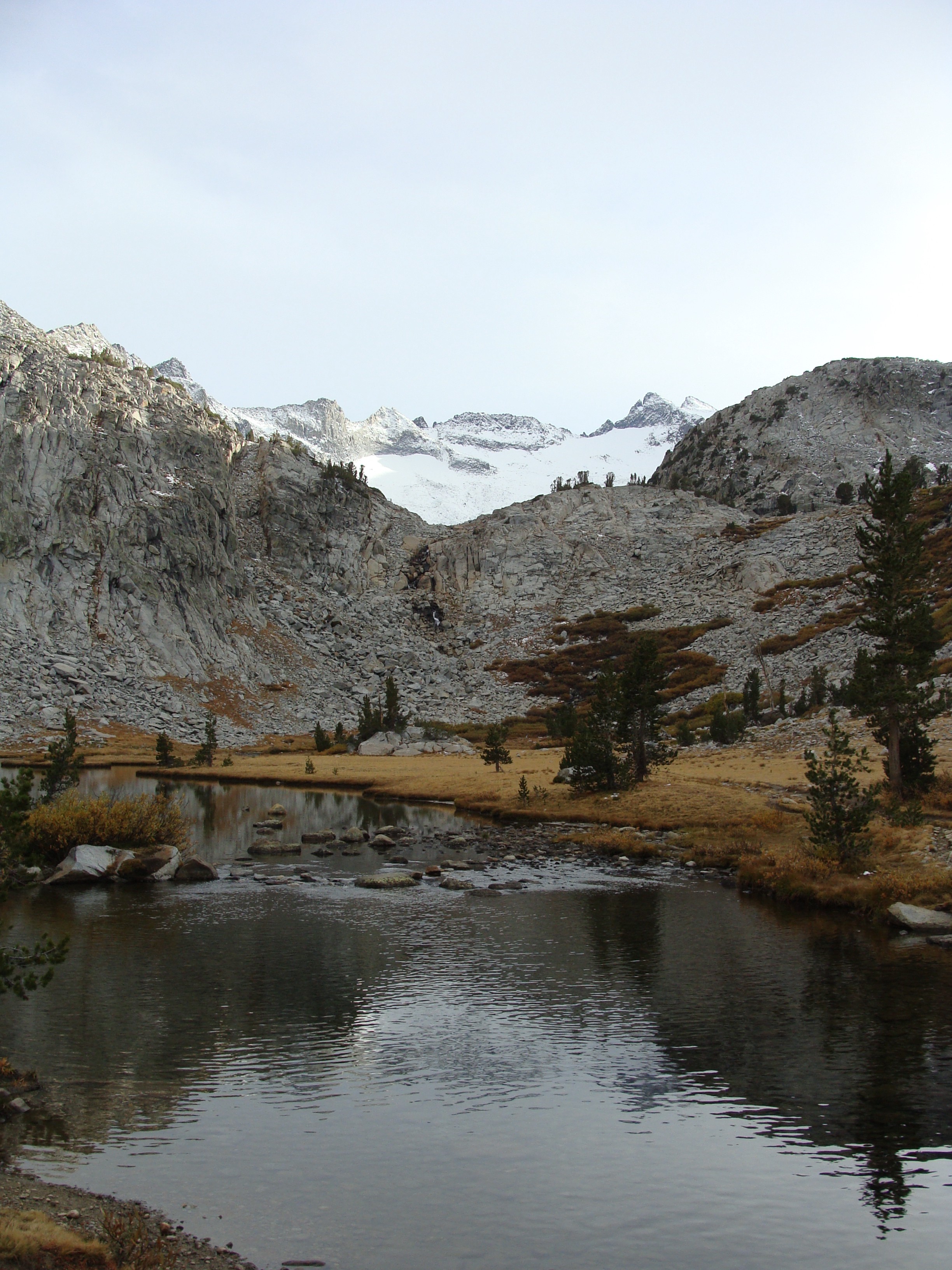
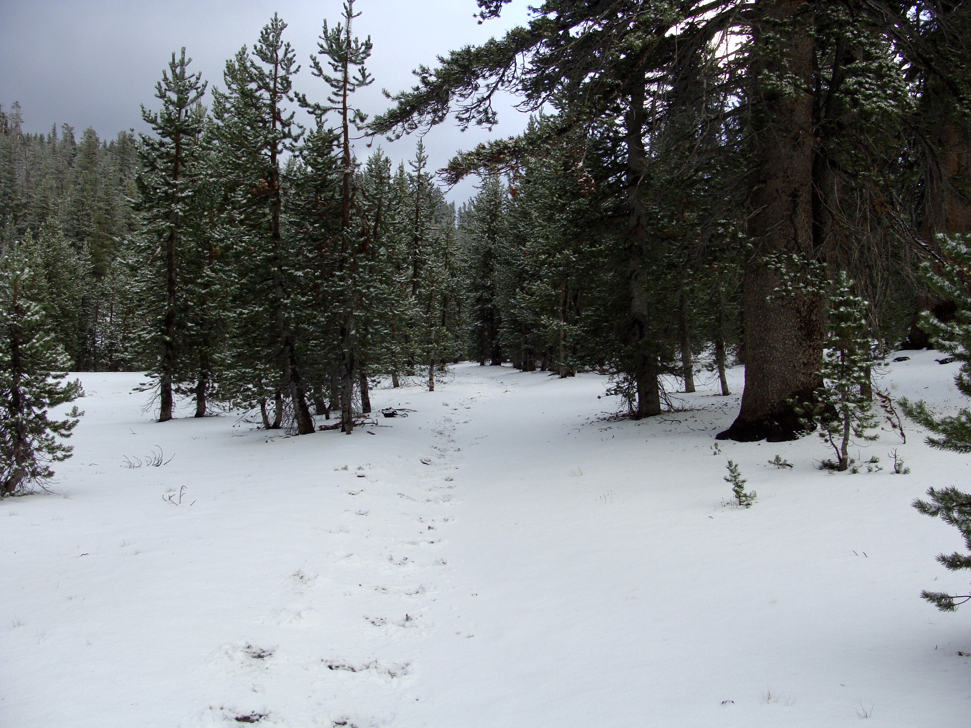
Time slowed to a crawl as the rain picked up again, but this time I elected not to stop. Facing projected lows in the teens I feared getting wet, but equally resented the thought of walking at night on frozen rocks. I made the best time possible, and after a few comfortable climbs I reached a sustainable pace. My muscles felt loose and my forty pound pack felt light. I climbed, and climbed, and climbed and climbed. Just before dark I checked my map, and identified my approximate location. I had topped out for the day after over 5,000 feet of climbing, but still had a two mile, slightly downhill traverse to Sunrise High Camp. On any other occasion, with the sun fading and temperatures plummeting, I would have seized the moment, tossed my tent and crawled into my sleeping bag – but this situation was different. I had a full day’s worth of food outside of my canister and Sunrise High Camp had a bear box. Staying at that campsite was the only way I could legally, and safely, camp along the JMT my first night. With that, I flipped on my headlamp for the first of many night miles to come. The frigid drizzle turned to light snow, and the wet rocks began to freeze. At this point I was well above 9,000 feet on the flanks of Cathedral Pass. I crunched downhill over frozen beds of pine needles, and shuffled cautiously over slick granite rocks. The night was still, as if I was the only hiker in the wilderness. Every time I stopped walking, either to snack or relieve myself, the stillness would become that much more evident. It was a beautiful feeling, a freeing sensation of separation from the material world. After one hour I crossed the trail junction for Sunrise Lakes, and followed the deviation east for a few hundred yards until an obvious tenting area appeared. The snow had subsided, and small, bright stars began to shine through the last wisps of storm clouds. I navigated the campsite by headlamp, finding the steel bear boxes, a four walled outhouse and finally, a suitable tent site. I chose one perched on a small knob, with hopes of sunrise views the next morning. I don’t remember much from that first evening, other than it was bitterly cold, and only became cooler the longer I sat outside. I assembled my tent, inflated my sleeping pad, unrolled my sleeping bag and immediately began boiling my pouch of Moong Bean Dal, an Indian split lentil soup with carrots and spinach. I stirred in some leftover quinoa from the car, scarfed the entire pot with ferocity, locked up my food and retreated to the confines of my down sleeping bag. Inside the bag I was warm and toasty. I wrapped my feet in wool socks and put on every layer of clothing I had, including my rain jacket for insulation. 13.5 miles down, 197 to go — but hey, at least I was under two hundred.

Day Two (Sunrise H.C. to Donohue Pass South, Marie Lakes Runoff — 26.5 miles)
My ankle, while feeling immaculate the day before, had given way to a pulsating pain from the outer bone. Riddled with insecurity I tried to downplay the looming 190 miles as best I could.
Overnight the clouds parted ways, allowing the temperature to plummet well below zero. I lost feeling below my ankles. The walls of my tent froze, forming small sheets of ice over my head. I shuffled my feet closer towards my body, scrunching into fetal position. I couldn’t move, even though I knew I needed to. I tossed and turned for hours, not sleeping more than a few minutes, until the first glimpses of morning light lured me outside. By the time I emerged from my tent it was past 6:00 AM.
Outside the protection of my tent, a slight dawn breeze pierced through every layer of clothing I wore. As my pot of instant coffee heated I quickly collapsed my tent and stuffed away my overnight gear. I’m not sure the water ever boiled, but it was warm enough to dissolve instant coffee grounds. I poured a quarter box of granola into my half empty peanut butter jar and dug in with my titanium spork. The peanut butter solidified into an icy, paste-like sludge that was very difficult to swallow, but I did my best, washing down each sip with barely tepid coffee. The remainder of my water was frozen solid in the recesses of my bottle. I still couldn’t feel my feet. It was time to move.

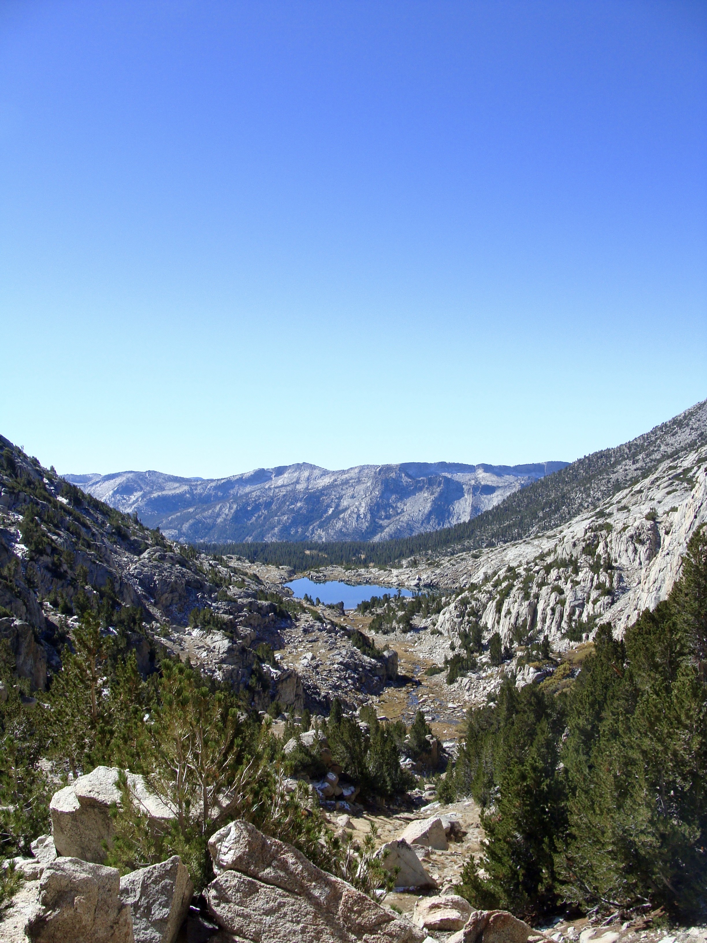
The morning light gave way to an amazing glacial meadow criss-crossed by a handful of small, frozen streams. Along the periphery, large granite spires wound upwards similar to the hoodoos of Bryce Canyon. A thick frost blanketed the forest, and footprints of previous hikers were fossilized in the trail. I moved as quickly as I could, trying to warm my feet by shortening my stride. Lucky for me, the trail climbed a few hundred feet directly to the top of Cathedral Pass, and by the time I reached the summit I was greeted with the warming rays of sunrise. Compared to sub-zero darkness, the rays of sun beaming off my down jacket felt divine. I had finally topped out on the 5000′ climb out of Little Yosemite Valley, and had a five mile descent to Tuolomne Meadows followed by a 7.5 mile flatland traverse through Lyell Canyon. I felt reasonable physically, but after 18 straight miles of uphill travel I was eager to walk with gravity for a while.


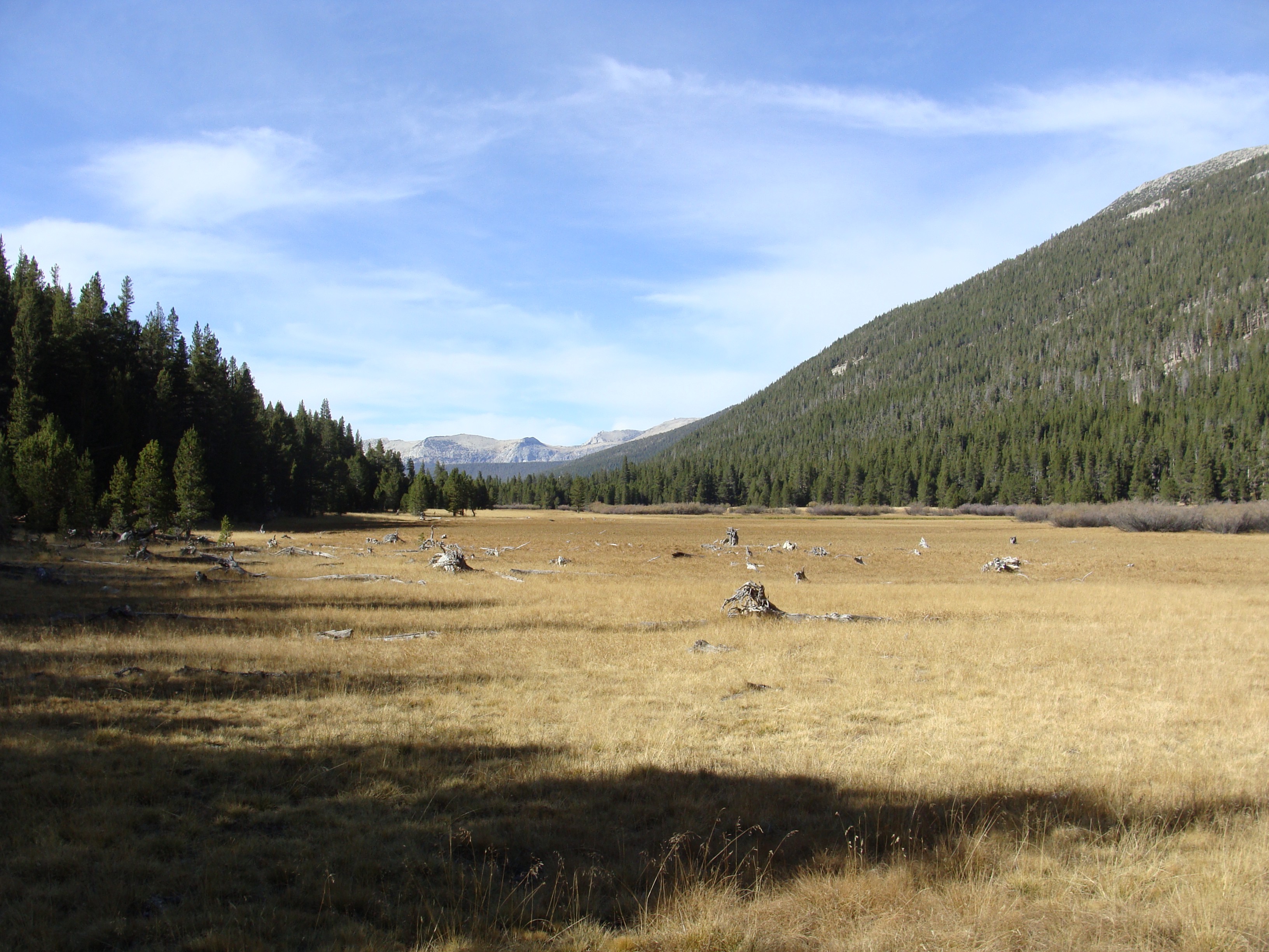
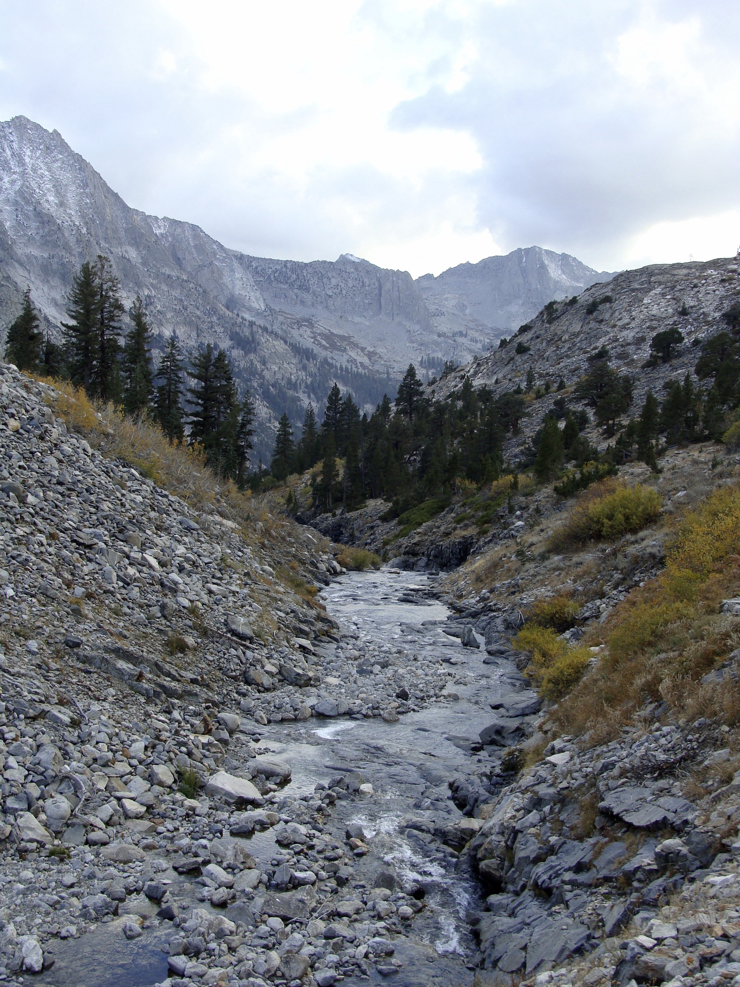
By mid-morning I passed the Tuolomne Meadows Wilderness Permit Office, the same place I picked up my JMT permit the day before. By noon the sun had risen to full height, warming the bottom of Lyell Canyon to seventy degrees. The temperature swing from just six hours prior, when I had borderline frostbitten toes on the flanks of Cathedral Pass, was astounding. I really couldn’t believe I was sweating again. The bottom of Lyell Canyon was a mostly dry meadow bisected by a moderately wide river and walled on either side by 11,000 foot peaks. The canyon belly stretched as far as the eye could see, and the trail, which was mostly blown out dirt, wound peacefully through a pine forest on the western banks. Being so close to Tuolumne, I passed many weekend hikers and a few overnight backpackers. I stopped to chat a couple times, neglecting to talk of my aspirations to hike the entire JMT. My stock response was “I’m heading up Donahue Pass,” – nothing more. My ankle, while feeling immaculate the day before, had given way to a pulsating pain from the outer bone. Riddled with insecurity I tried to downplay the looming 190 miles as best I could. The whole afternoon I used the flat terrain as an excuse to let my mind wander, a distraction from the pain. By four o’clock I had covered over twenty miles and was perched along the banks of the cascading Lyell Creek, where the 3,000 foot uphill surge to the top of 11,073 foot Donohue Pass begins.
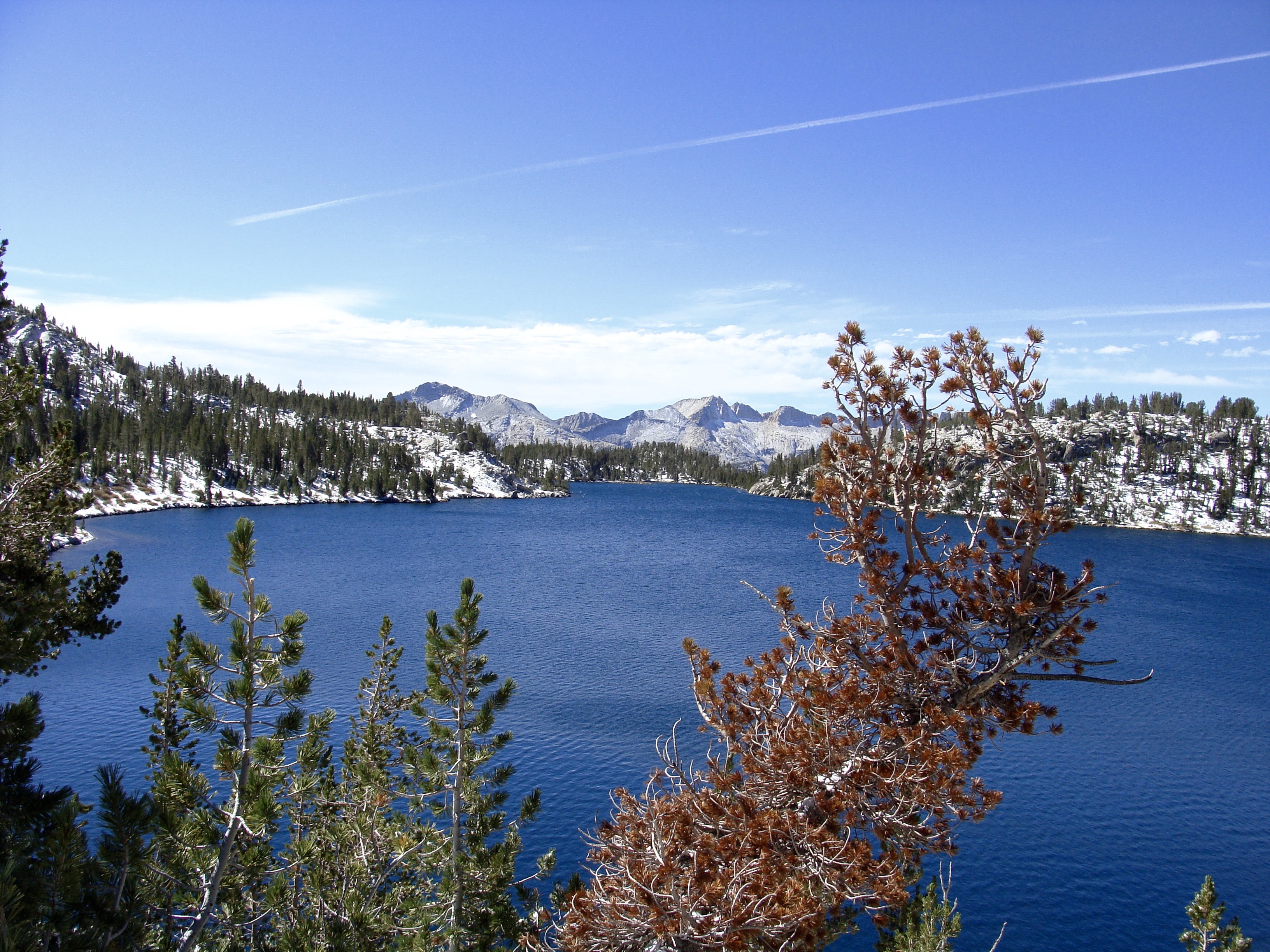
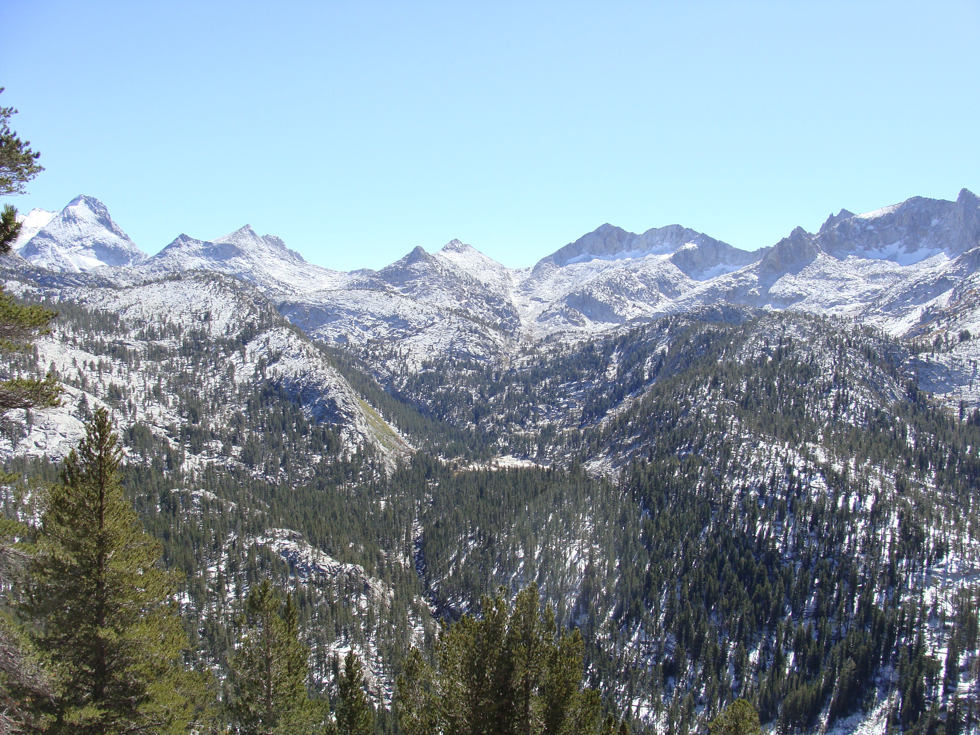
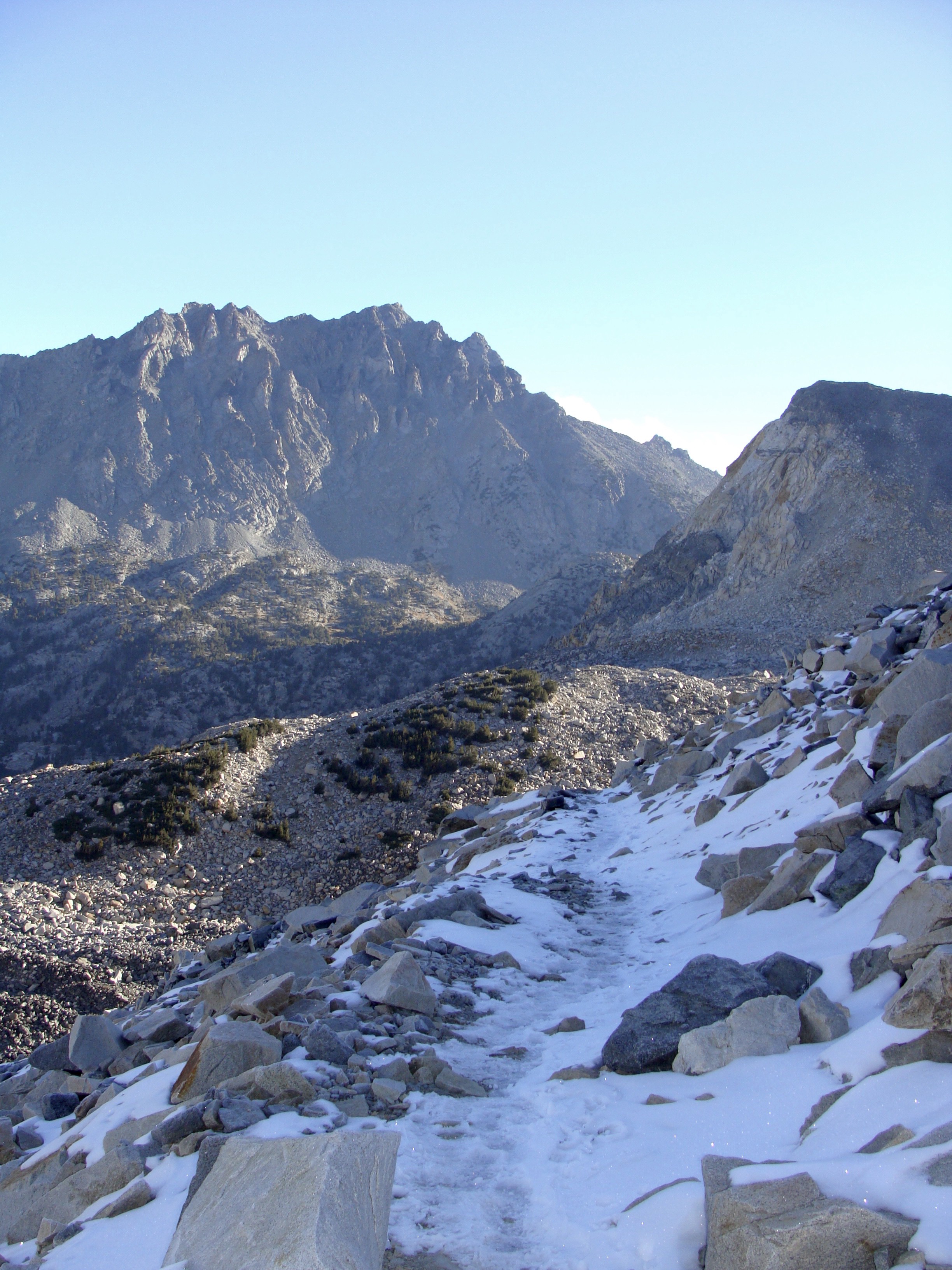
I wound up, and up… and up… losing daylight with every step. Another chilly breeze emerged as I ascended above 10,000 feet. After two miles of granite slabs I came to a small basin dotted with lakes. A beautiful north-facing cirque greeted me, covered in a considerable blanket of snow. I stopped, staring wide-eyed at terrain I’d typically consider a ski objective. I couldn’t fathom how I would climb such a pitch without ice tools. Hesitantly I wound onward, trying to guess the approximate path of the JMT. I feared the trail could already be buried. Lucky enough, after reaching a beautiful high alpine lake filled with snowmelt, the trail took a sharp turn to the east, pointing directly at a mostly dry slope of scree and talus. I scrambled the final thousand feet to the summit of Donohue Pass with ease, crossing only a handful of snow patches no more than a few meters wide. From the summit of Donohue Pass, the Yosemite National Park southern border, I caught an amazing sunset view over the mountains of Inyo National Forest. I had fulfilled my goal for the day, but a now stronger, bone chilling wind gust ushered me off the summit. I took refuge behind a large boulder, changed into long underwear, slipped on my down jacket and clicked on my headlamp, proceeding down a jumbled rock field into the twilight. Fortunately the aspect was snow free, and less than an hour later I regained the tree line, finding a flat spot beside a small stream to camp. Both my knees and ankles were throbbing. Despite my aversion to western medicine, I slipped a few Ibuprofen down my throat with dinner that evening. I treated myself to the tastiest of meals, the freeze dried marinara pasta my mother gifted me last summer. The “Good to Go” brand is family owned, and uses only organic and low sodium ingredients, a far superior meal compared to the typical bag of freeze dried gruel sold in hiking stores. The night was much warmer than last, just mild enough to dine beneath the stars and retain feeling in my extremities throughout the night. The sounds of a trickling creek lulled me peacefully to sleep, my mind satiated with accomplishment over having the first of eight “marathon” days behind me.

Day Three (Marie Lakes Runoff to Deer Creek Trail — 26.4 miles)
The experience was very trance-like. I called it “entering the twilight zone.”
I awoke around 4:00AM to the light sound of frozen snow pellets glancing off my rain fly. I hadn’t seen snow in the forecast. I crawled out of my tent to a few soft inches of white around my tent. At least the temperature was closer to 32 degrees, so I was able to sleep soundly and awaken peacefully. I opted to tackle 10,221 foot Island Pass by headlamp before the snow made travel any more difficult. I was out of camp within half an hour.
Pre-dawn hiking, which I feared at first, turned out to be my favorite time to hike. Moving through the wilderness guided only by a narrow beam of light demands an intense level of focus. I could only see two, maybe three feet in front of my stride, and with a trail of mostly snow covered rocks it was imperative I watched every last step. Having to concentrate so hard slowed my pace to an almost meditative saunter. Sometimes several minutes, even hours, would pass where I wouldn’t lift my gaze. The experience was very trance-like. I called it “entering the twilight zone.”
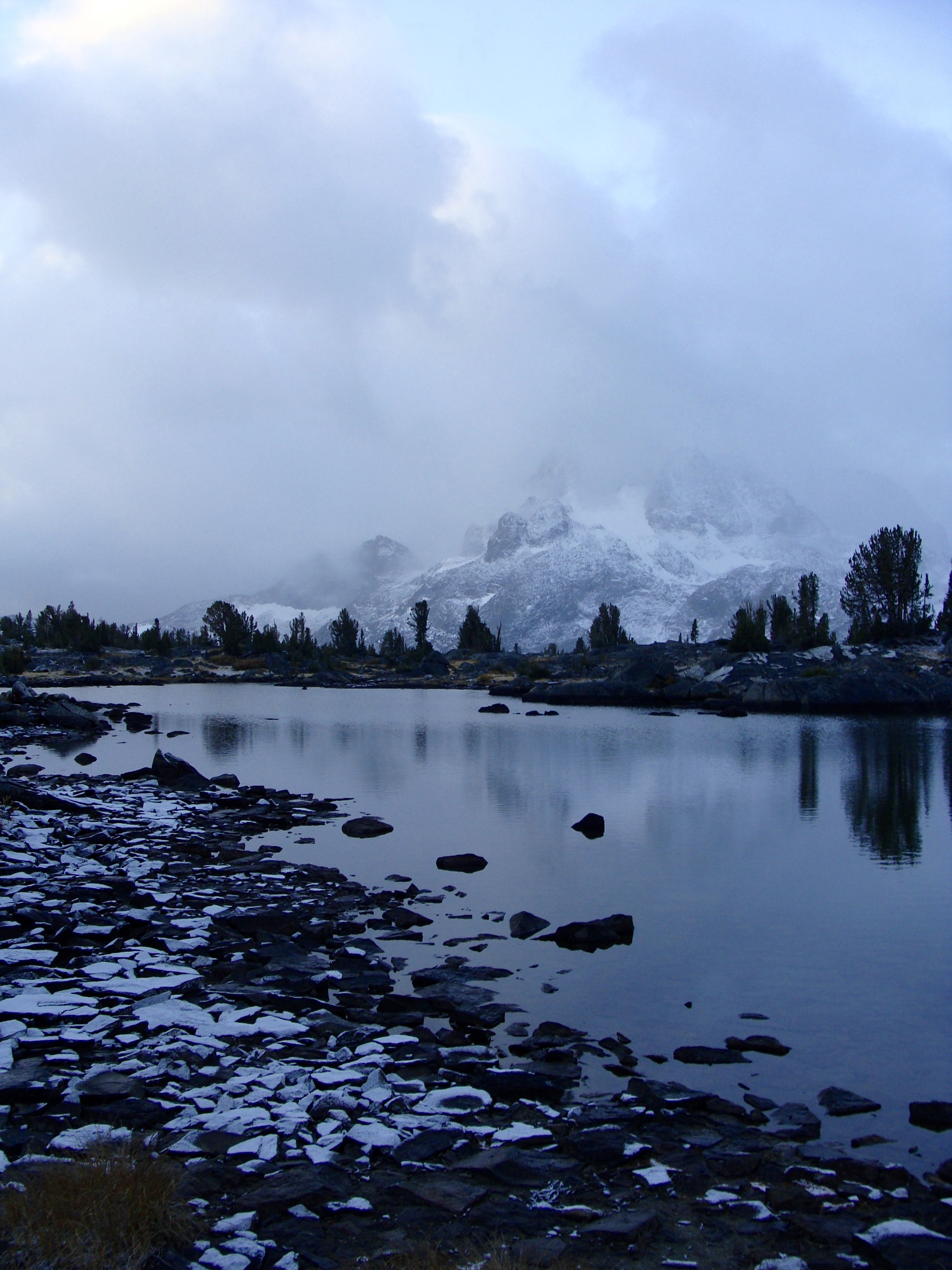
By true dawn I’d crested Island Pass, and crossed ways with a couple military northbound hikers. I was glad to see other human beings were braving the snow as well. Atop Island Pass, a small, semi-frozen lake was perched right alongside a hanging cliff face. The thick clouds were beginning to show signs of breaking, allowing the first beams of sun to brighten the wilderness. Off the surface of the lake, I could see a stunning mirror reflection of jagged, ice covered peaks in the distance. Shades of pink and orange danced from the mountaintops with spectacular beauty. Another gorgeous day in the Sierras had begun.
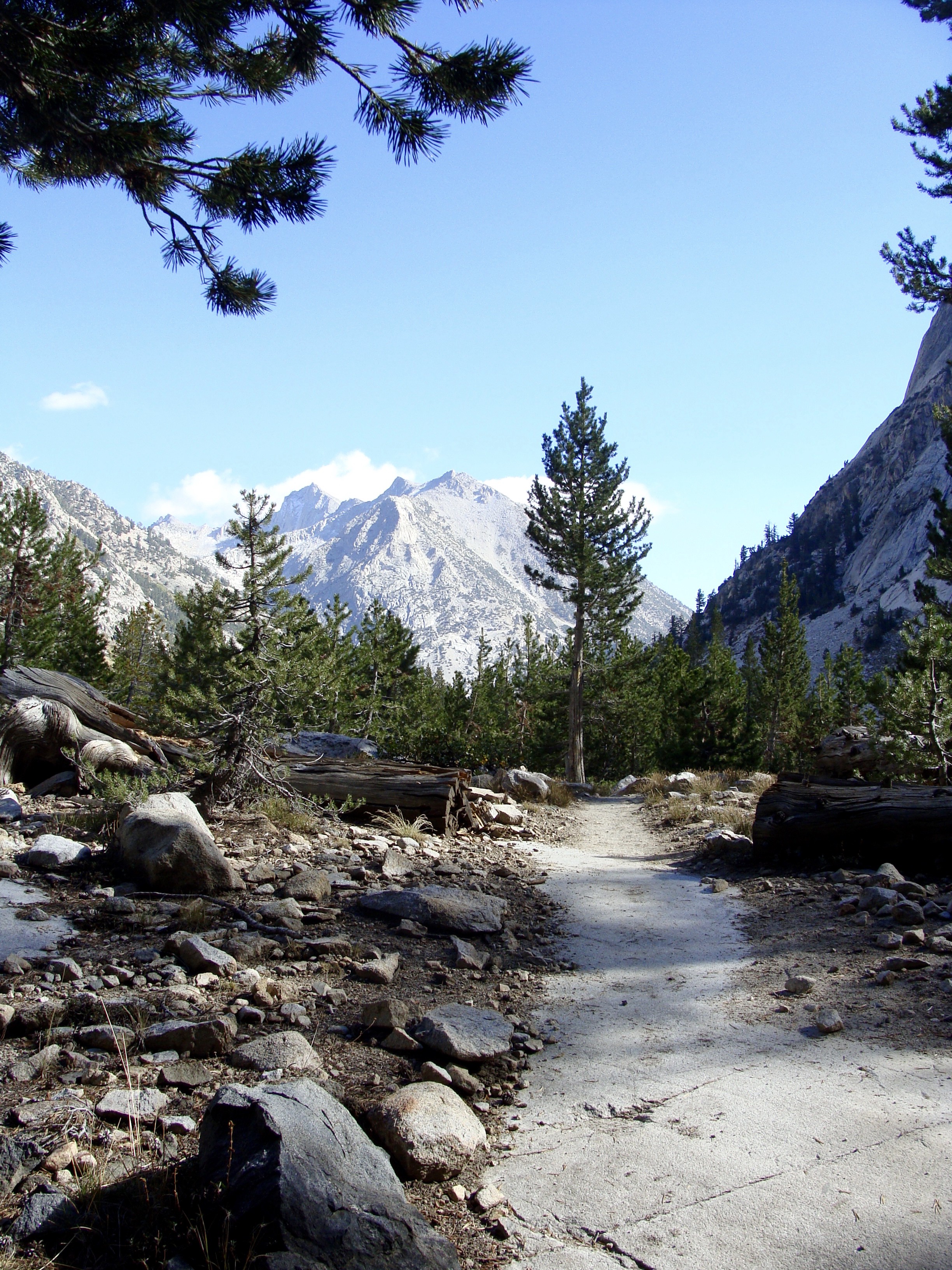
From Island Pass I wound downward on a slick granite staircase towards 1,000 Island Lake, a popular weekend destination. I was warned of many backpackers camped along the lake, but I didn’t see a single one. I took a spur trail towards Agnew Meadows (which I would later find out was not the JMT) and eagerly broke into a light jog on the gentle downward sloped trail. My legs felt strong as I skipped with an excited pace. After climbing for so many hours the past few days, I was elated to be moving effortlessly on the crisp and clear morning. However, after nearly two hours of romping I realized I hadn’t seen a trail sign for miles. I was quite thirsty, low on water, and beginning to doubt I was even on the JMT. I checked my map. Right on time, two exhausted looking backpackers came bounding up the trail. “Is there any water up ahead?” I asked. “A few small streams a mile up” they replied. No mention of Garnet Lake, which I was expecting to materialize around any corner. I was lost. I scanned my map meticulously, realizing I must’ve taken a wrong turn at 1000 Island Lake. I was somewhere along the Pacific Crest Trail, descending the San Joaquin River Valley. If I retraced my steps, the mistake could cost several precious hours. Instead, I would follow the PCT to Agnew Meadows and further to Devil’s Postpile National Monument, where I could regain the JMT. The mileage seemed nearly equidistant, so it seemed only logical to continue on.

The day warmed quickly and the sun burned off every visible cloud in the sky. By noon I was back in shorts with rolled sleeves and a baseball cap, making excellent pace to the valley floor. Being a Saturday, I passed several hikers headed upwards to 1,000 Island Lake for the weekend. I warned them of snow and sub-zero temperatures. One woman, after hearing of my over-the-top lightweight stubbornness, gave me a travel size tooth brush insisting I prioritize dental hygiene. After picking up the brush, which folded into itself and weighed no more than a full matchbox, I agreed to accept the gift. I passed through Agnew Meadows and continued downward following PCT signage to Devil’s Postpile National Monument. After hiking above 9,000 feet for the past 30 miles, dropping into a low forest was a welcomed shift in scenery. The trees were still green, and the San Joaquin River provided a soothing ambient noise of rushing water. Down… down… down… My knees and ankles were starting to throb. I only took two Ibuprofen to start the day, but by the time I reached the footbridge at Red’s Meadow Lodge (closed for the season) I desperately needed another pill. I’m usually not one to complain about descents, but the Sierra Range was just so much “bigger” than anything I’d ever experienced. Fifteen consecutive miles of thudding would wear any hiker thin, and having already covered twenty miles by 2:00PM, I was especially sore.
Red’s Meadow was the predetermined bail out point for my battered ankle. The thought of quitting didn’t even cross my mind as I blew straight through the trail junction. Thunder clouds began to build in the sky, obscuring the sun and stirring up a slight wind. After a series of loud cracks, hail began to fall. The ice chunks started small and light, progressing quickly to dime-sized pellets. I slipped on my rain shell to deflect the ice and was immediately transported into something of a military video game. “Patter patter patter…” the hail smacked against my hood like shots from an automatic rifle. The projectiles that connected with my bare calfs stung like horse fly bites. Battling such horrific weather, I was jolted with a sudden surge of adrenaline. The same effect happened regularly on the Appalachian Trail, where high winds or intense rain allowed me to access a hidden reserve of energy, and hike with more tenacity than I knew possible. In Red’s Meadow, battling the worst flash-hail storm of my life, I harnessed the same power. My muscles loosened. Thoughts of fatigue melted away. My focus became narrow, fixated only on the next step. I began to power walk, increasing to a light jog. Lightening hammered from the sky as I floated up the two thousand foot ascent to the crest of Mammoth Pass, seemingly weightless, as if propelled by a force greater than I.

Eventually the hail turned to warm snow… wet, heavy and slippery. I passed a few other tents set up alongside the trail with no signs of human life. I thought about waving the white flag, grabbing a semi-dry tent spot and making use of the fleeting daylight to get warm, but that would mean extra miles the next day — and I didn’t have that luxury. Instead I pulled a bag of dried figs from my hip pocket and continued to climb over the slush covered rocks into the Sierra alpine. Winding upwards from Mammoth Pass, the trail meanders through a thick forest, following streams and crossing several high meadows. Draped in a veil of white the wilderness took on a dream-like feel. As I strolled through the snow dusted pines I I couldn’t help but be reminded of New England. On cold, winter mornings my father and I often walked into Harold Parker State Forest, through similar looking pine groves which eventually terminated in a small lake. I remember the peace those walks gave me, an immediate relief from what otherwise was a bustling Boston suburb. If someone had simply dropped me out of the sky into the John Muir Wilderness that snowy October afternoon, I would have probably guessed I was somewhere in the Harold Parker State Forest. I was home.
My tension eased as I became accustomed to the slippery trail underfoot. I focused less on the physical discomfort of approaching my second consecutive marathon day, and instead shifted my attention to the beauty around me. The sound of rushing water in the distance. The tweeting of birds and the tracks of small rodents scurrying through the now several inches of accumulated fresh snow. I entered a meditative mindset, time seemed to stand still. I squeezed every last minute of daylight from the cloud-covered sky until finally deciding to hunker down at Deer Creek. My map warned this was the final reliable water source until Duck Creek four miles ahead, and the temperature was beginning to plummet. I was soaked to the bone, and needed to dry out before nightfall. A gang of five PCT hikers were camped along the creek as well, and judging by their snow free campsites, must have retired many hours before. Magically, I found a small grove beneath a towering oak tree that was virtually snow free — as if I had made a reservation. Wasting no time, I changed into my down layers, wool socks and face mask. I boiled a large pot of water and poured it into my reusable freezer bag to re-hydrate a homemade vegan corn chowder with split peas, potatoes and green beans. Grasping the warm pouch of re-livened mush between my legs I stared openly into the now darkening landscape outside my tent. Snuggled tightly inside my sleeping bag I could feel my toes again, my fingers and my nose. My tent filled with the aromas of cooked food. I cracked open the pouch and poured a liberal dousing of olive oil and Sriracha hot sauce. The corn chowder really hit the spot, unlike any camp meal I could remember. For covering over sixty miles in two and a half days, my muscles felt surprisingly lively and my ankle virtually pain free. I slurped down the final gulps of lukewarm soup, slugged half a bar of dark chocolate and zipped up my rain fly for the evening. The sky was slowly clearing… giving way to dim stars. “Perhaps the snow would pass…” I remember thinking.


Day Four (Deer Creek Tr. to Mono Creek/Lake Edison Tr. – 21.7 miles)
“Carrying for two-hundred and twenty miles?! That’s hardcore, so hardcore man”
“Two-step”
I was surrounded by fresh snow. I couldn’t believe my eyes. The time was only 2:30AM, but the sight of white startled me awake permanently. As soon as my coffee grew cold I itched to move – per the sub-freezing temps, this happened quick. Today was going to be slow. Unlike the previous day, there was actual quantifiable accumulation, a stout three or more inches in spots. Within twenty minutes my camp was disassembled and I was staggering by headlamp through the ankle deep snow. Storm clouds had covered the night sky, rendering the woods pitch black. I moved slowly, cautious of rocks or roots that might be underfoot. I didn’t have much of a trail to follow, instead looking for the logical, debris-free route through the dense forest. In a pristine wilderness such as the John Muir (I had crossed out of the Inyo National Forest yesterday), all ground besides the trail is exactly how nature intended it to be — laden with decomposing logs, large rocks, and small bushes. At first, I feared walking without a trail… what if I got lost? However, when I allowed my senses instead of my mind to follow the trail, I was able to travel with ease. A few times I would wander astray, catching myself by the sound of crunching leaves beneath my feet. A well beaten trail feels like a well beaten trail, that is, free of sticks, leaves and large obstacles. I looked for markers to confirm my course, such as sawed off logs or the occasional PCT marker tacked to a tree trunk. The more I thought about getting lost, the more I strayed from the path. When I was able to harness my instincts within, I was able to walk through the snow-covered blackness with ease.
As the sun rose I was delighted to see I was still on the JMT. A trail of footsteps leading from an nearby campsite told me so. I followed the tracks south, criss-crossing several drainages, climbing steadily along a high mountain ridge. The storm had returned with a vengeance, burning the sides of my face with whipping winds and small ice pellets. I was hungry, but feared my body heat might drop dangerously low if I stopped to eat. I kept one hand in my pocket until the other couldn’t bare to hold trekking poles any longer, then swapped them out. Finally, after eight miles of slipping, sliding and staggering I rounded a corner into sunshine. I huddled beneath a small rock enclave and sprawled out in the morning light. I was surprised how fast my body warmed, and within five minutes I shed my outer layer and slipped off my face mask. I snacked on a second breakfast of nut butter “tacos” rolled between large pieces of dried mango leather – not as bad as you would think – and sipped on unfiltered water from Duck Creek, for my Sawyer water filter succumbed to the cold, rupturing earlier that morning. I came to the shores of Purple Lake a few miles later, then climbed high to the landlocked Virginia Lake, both shimmering in rays of sunlight. The white snow contrast against the deep blue water made for the most dramatic of landscapes, much like an early winter scene I enjoyed at Crater Lake National Park a few winters ago. On the shores of Virginia Lake I met two PCT hikers drying their tents, the same two whose footsteps I’d been following since Deer Creek. I’d spent the latter half of my morning wondering whom I was following and if I’d ever catch up to them, especially since I was carrying a knit beanie I’d picked up, hoping to find it’s owner. They introduced themselves as Gus and Nightwalker, PCT South-bounders. Gus was the owner of the hat, and was grateful I’d come across it. “I never thought I’d see it again” he exclaimed excitedly. The two guys were about my age, dressed in typical thru-hiker fashion; tattered clothes and worn packs, in desperate need of a shave and eating boxed cereal by the handful. They reminded me of myself after a thousand miles on the Appalachian Trail. It was a relief to see there were other humans battling the wintery conditions, but besides the three of us (one other in their party was a few miles ahead) I wasn’t sure there was anyone else in the Sierras.

The trail leading into Silver Pass, the crux of my afternoon, was just mellow enough to lure me into hiking faster, but just steep enough to remind me why my bones ached. The ascent was over four miles, requiring pace and patience. Around the halfway point in the climb I began to feel a nagging twinge in my right ankle. I paused, stretched, ate a snack and continued, only to halt a couple yards later. The pain was dull, but not dull enough to ignore. The scenery was incredible, rife with alpine lakes and towering canyon walls, but the pain had invaded my headspace, clogging my ability to think. The higher I climbed the more pronounced the pain became. I resorted to a hobbling motion, taking each granite slab with my left leg and then raising my weakened foot to meet it. I began to fear the worst. Had I been shortsighted in bypassing Reds Meadow road? I tried to focus my attention on the ankle, to identify the exact motion that caused the pain. I clambered along for what felt like an eternity, making stride adjustments, stretching and intermittently sitting down. Eventually, after a series of heartbreaking false summits, I crested the top of Silver Pass. From the summit I had a three hundred and sixty degree view of the Northern Sierra Range beneath a cloudless and sunny afternoon sky, but I could hardly bring myself to appreciate it. I immediately sought shelter beneath a lone grove of trees on the south side of the pass. The wind had picked up and I needed to regroup. Gus and their other friend I hadn’t met yet, Two-Time, were utilizing the same windbreak for lunch. I tried to muster a smile as I introduced myself, but I was in a lot of pain. I sat down, wrenched off my shoe and untied my ankle brace. My foot was swollen and tender to the touch. I elevated it on a log, ate a handful of Ibuprofen and pulled out my jar of almond-cashew butter as more of a distraction than a necessity. Looking south into an endless sea of daunting, snow-capped mountains, I feared the worst. I imagined a straight line through the mountains and the physical energy it would take to hoist my swollen ankle, tired body and now thirty pound pack over another six mountain passes. Two-Time’s reaction to my eight day unsupported hike attempt was anything but reassuring: “Carrying for two-hundred and twenty miles?! That’s hardcore… so hardcore man.” he said in a thick, native German accent. At the moment I felt anything but hardcore. I felt weak – so weak that I wanted nothing more than to retreat back to society on the next available spur trail. I looked down and realized I’d eaten more than half my jar of nut butter, a sure product of stress and physical exhaustion. Only fifteen miles into my day, I knew beyond any shadow of a doubt I would be unable to make another twelve. Six miles further was Mono Creek and the side trail to a closed Vermillion Valley Resort. The hostel had only closed a day earlier, so I figured there were likely workers tidying up before winter. If I really couldn’t continue, VVR could be the escape hatch. I planned to camp along the banks of Mono Creek and make my final decision after a long night’s rest.
The rest of the afternoon flew by in a daze. With six hours of daylight to hike less than six miles, I joined the PCT crew for a leisurely descent. We wound passed many alpine lakes, eventually dropping abruptly towards Mono Creek. The waist high, off-kilter stairs shot pain through my Ibuprofen shield. Slowing my pace didn’t help much, so I opted to jog ahead of the crew to reach the camp as quickly as possible. I limped to the Mono Creek Footbridge feeling utterly defeated. Together with Two-Time, Nightwalker and Gus I tossed my tent in a patch of wind-sheltered pines. The others were aware of my condition, and offered little encouragement after seeing the pronounced swelling and bruising beneath my sock. Stopping short after less than 22 miles, I was now half a day behind. I couldn’t stomach the idea of quitting or the fear of getting stuck in the Sierra Alpine. My mind rattled between doubt and perseverance. Should I quit? Would there even be any employees at Vermillion Valley Resort? How will I get off the JMT if I continue and get stranded? What if I get snowed on again? The indecision shook me to the core. I had had enough. In the morning I would hike to the shores of Lake Edison, or to the nearest road if need be. 80 miles in — my hike was over.

Day Five (Mono Cr. to Evolution Creek, McClure Meadow — 30.7 miles)
Sometimes you just do things
Scott jurek – Eat & Run
The time was just after midnight. The temperature had dropped well below freezing. I was working my way up one of the steepest ascents of the John Muir Trail, two-thousand vertical feet to the crest of Bear Ridge. The soles of my shoes crunched through the frozen dirt. My headlamp illuminated only the ground directly in front of me. I stared blankly at my toes, hypnotically prodding along at a slow but steady pace. I could see every breath leave my mouth as a cloud of frozen haze. Somehow, some way, I was still moving upwards.
I had barely slept the night before, largely because my mind was fixated on quitting. My swollen ankle screamed for reprieve with every ounce of pressure from my sleeping bag, but my heart wanted nothing more than to forge on. “Sometimes you just do things” the adage from Scott Jurek’s (a famous ultra-marathoner runner) autobiography rang on through my head like a curse. Around midnight I chased a half-dozen Ibuprofen with a cup of scalding coffee and laced up my ankle brace. I couldn’t sleep through the anxiety anyways. I decided to attempt Bear Ridge, merely to clear my conscious at the least. From the summit, my map indicated a second spur trail leading from the Bear Ridge summit to the shores of Lake Edison. If I couldn’t persevere through the pain, I could bail out there. I thought of the time I climbed White Cap Mountain in the Hundred Mile Wilderness on the Appalachian Trail, just after fracturing my ankle. I implemented the same strategy I used then: shift majority of weight to healthy ankle — keep steady rhythm — small strides — deep breathes — no expectations. I climbed, and climbed, and climbed and climbed until the first glimpses of morning sun were beginning to penetrate the forest canopy. I talked to myself, whispering words of encouragement. I blocked out all thoughts beyond the next step. The trail sign for Lake Edison broke my meditative mindset, indicating the summit of Bear Ridge. Just like Red’s Meadow Road, I didn’t even consider breaking stride.
I sat down a few miles later, busting out my bag of homemade Tamari roasted trail-mix for the sunrise display. I had an easterly view of the mountains, perfect to view the morning sun. My ankle hurt, but not enough to quit – or, not now at least. The sunrise over the frozen landscape was jaw-dropping. Atop Bear Ridge the mantra for my John Muir Trail adventure was born: “I’ll re-group there.” Scanning my map, I broke the rest of my day down into sections. Looming ahead was Seldon Pass, another monstrous three thousand foot ascent. I would look no further than those next six miles, and “regroup there.” I wasn’t sure I could hike another 118 miles, but I felt pretty confident about six. After the sun brightened the trail, I descended Bear Ridge and headed directly into Seldon Pass, following the banks of Bear Creek. I found an odd reserve of energy, and before long was staring up the final scramble to the summit. The beautiful Marie Lake was landlocked by an impressive cirque of snow capped mountain peaks. Just like Donohue Pass prior, the trail managed to climb one of the only snow-free rock faces. Whomever designed the JMT was incredibly mindful of solar aspects and their effects on snow. I reached the top of Seldon Pass on little more than a limp. Time to re-group. Another few Ibuprofen accompanied my lunch of sprouted grain tortillas, dried figs and nut butter. Following the same method, I pinpointed my next regrouping point at the Kings Canyon National Park Border, ten downhill miles along. I left the summit of Seldon Pass before noon, traversing the wooded shores of the Sallie Keyes Lakes before dropping into a young pine forest. I passed a group of three other southbound PCT hikers. I made my way down Evolution Canyon towards the San Joaquin River Basin. By this time the sun was high in the sky, warming the canyon walls to an almost unbelievable degree. I found myself skipping rhythmically down the steep embankment without thought of my ankle. With every painless step, my confidence grew. I came to the official halfway signpost of the JMT a few hours past the four day marker, and continued onward with a head full of optimism into Kings Canyon National Park. 106 miles down, 106 to go. The San Joaquin River Basin was teeming with life. A rampaging river raged through the valley, which grew increasingly narrow as I hiked uphill. Wildflowers burst from cracks in the rocks and young aspen groves displayed marvelous shades of orange, burgundy and mustard yellow foliage. The trail followed the banks of the river until a steel sign imprinted with “EVOLUTION BASIN” pointed directly up a sharp rock face. I re-grouped again, settling my mind and taking quick inventory of my ankle, all while shoveling down the last of my second jar of nut butter. I couldn’t believe my progress. Less than twenty four hours ago I was settled on surrender, and now I stood, twenty six miles later, at the mouth of Muir Pass. Before leaving the San Joaquin River I scratched “Dub-Wide” in the dirt with an arrow pointing south, accompanied with a big smiley face. Unlike the Appalachian Trail, the JMT did not have logbooks to sign. The inscription was my way of letting the PCT crew behind know I was still moving. Five more uphill miles by headlamp left me at McClure Meadow for the evening, with a lovely tent site aside the peaceful Evolution Creek.

Day Six (Evolution Creek, McClure Meadow to Glacier Creek — 25.5 miles)

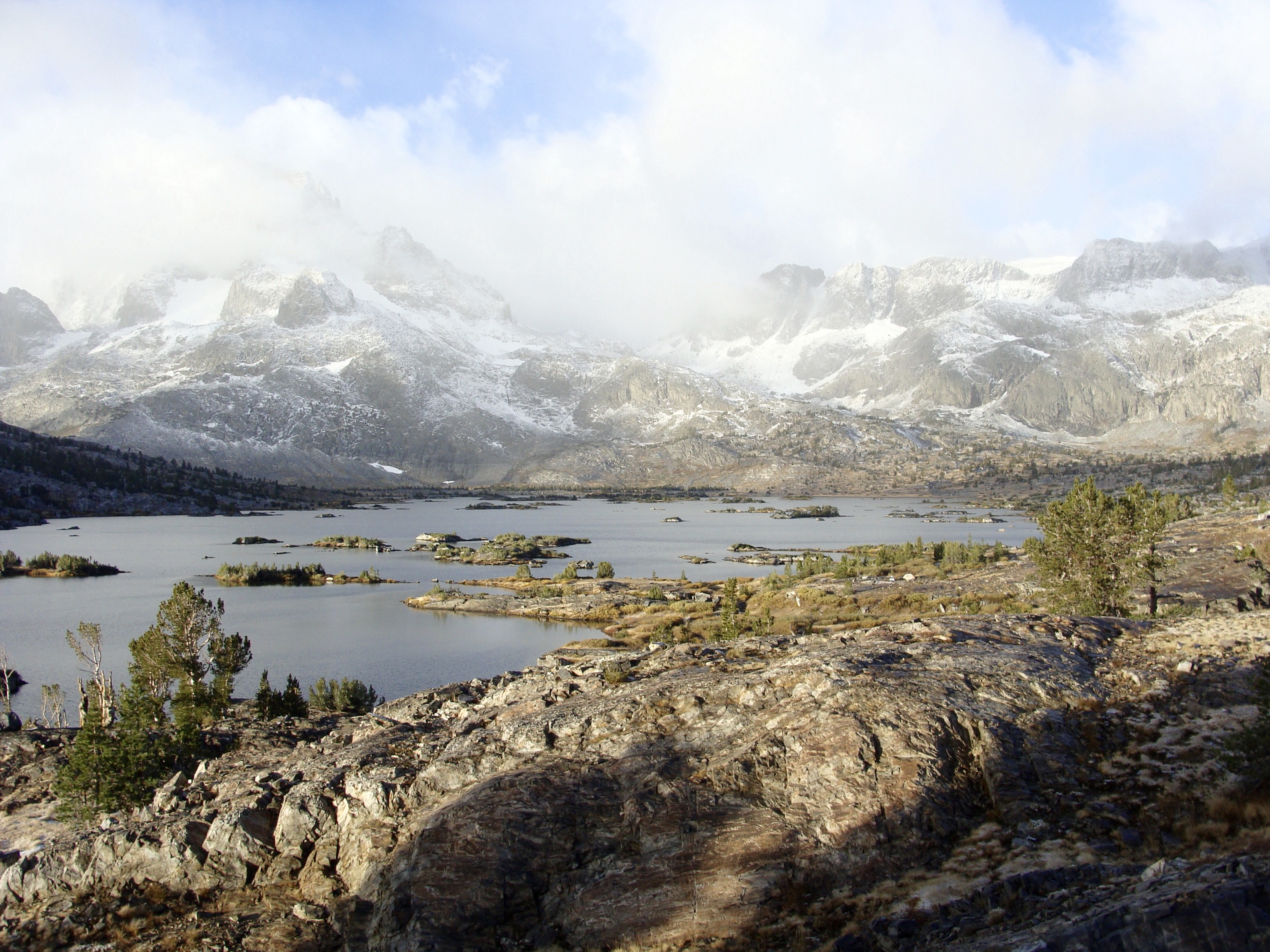
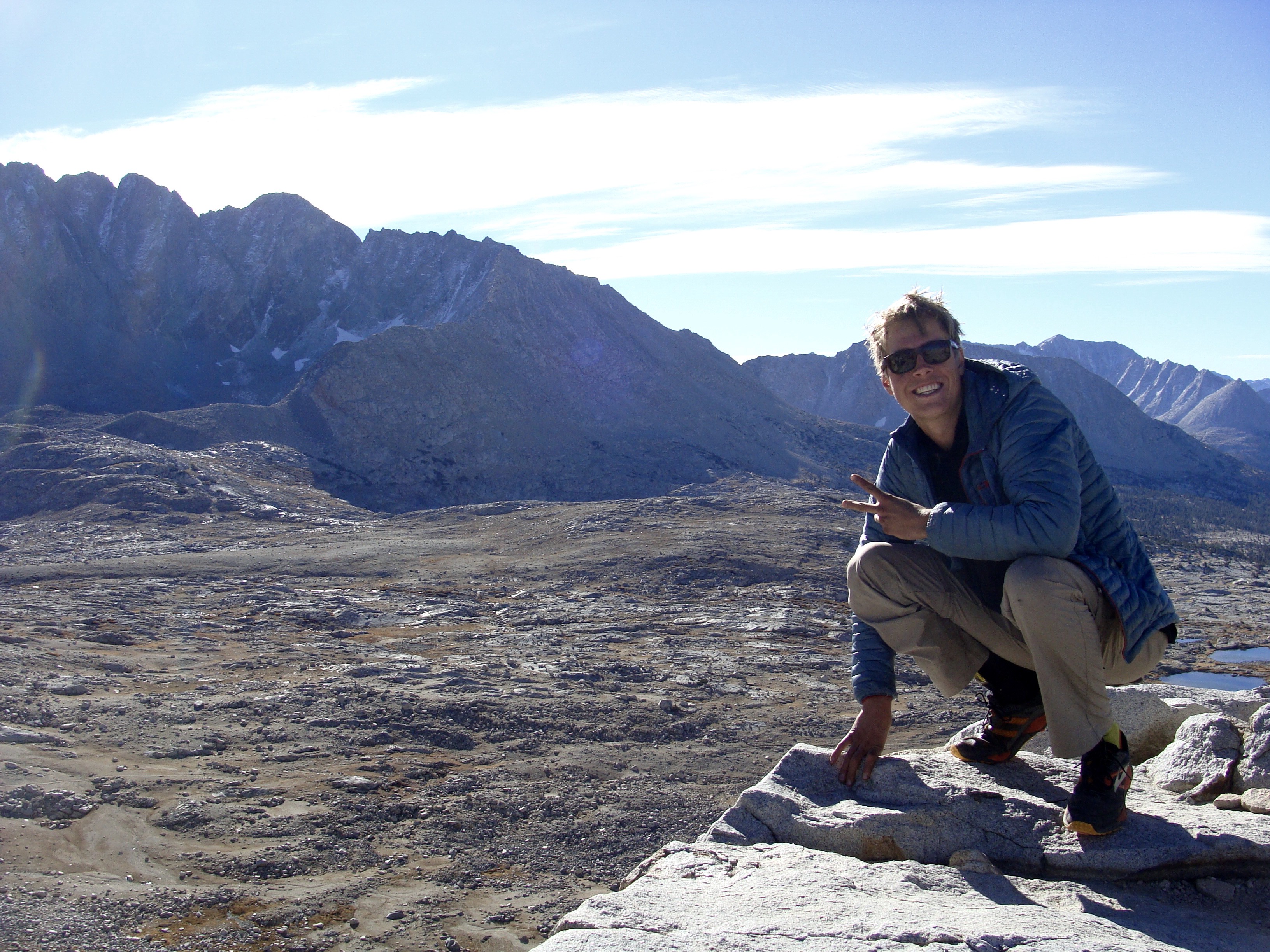
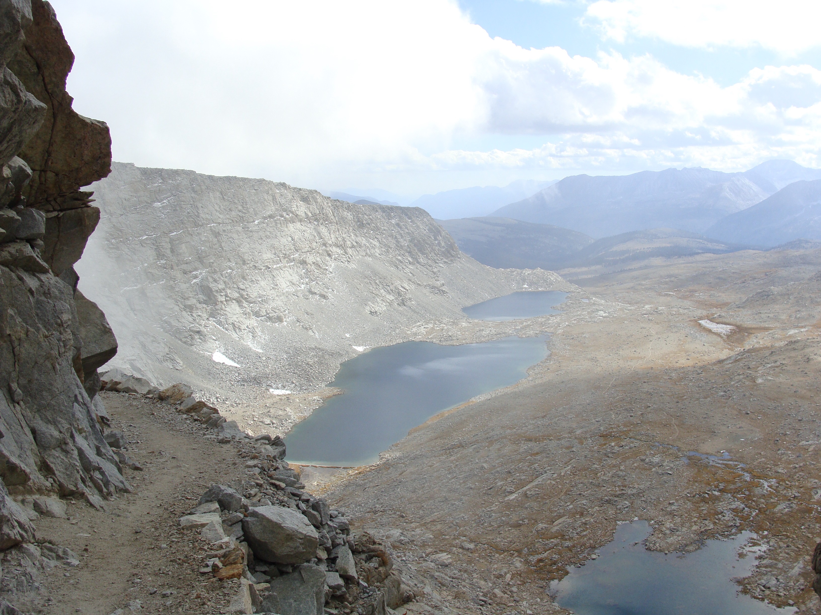
Muir Pass, at 11,975 feet, was the tallest summit I’d encountered yet — and according to PCT hikers could be holding significant snow. From camp, I followed Evolution Creek into Evolution Basin, home to an impressive chain of six alpine lakes. Each lake was connected by a small set of tributaries gently winding their way down the canyon. Around each bend, another mass of crystal clear water reflected the towering mountaintops. I spent over three hours finishing the 16.7 mile total ascent of Muir Pass, but was blown away by the sheer beauty of every minute. By the time I hit Wanda Lake, at 11,434 feet, the sun was high in the sky. I crossed only one snowfield on the final ascent, topping out on Muir Pass with relative ease. Surprisingly, my ankle took much better to yesterdays 30 mile rampage than I expected. I wasn’t pain free, but I reached a threshold I could comfortably grimace through – progress on it’s own. At the summit stood Muir Hut, a stone, cottage-like shelter erected by volunteers for emergency storm use. A forged metal placard on the outer wall read: “To John Muir — Lover of the Range of Light” With views south to another chain of deep blue lakes and sky tickling peaks in all directions, I truly understood what John Muir meant by “The Range of Light.” It felt like an alternate universe – a space crater far beyond the reaches of planet earth. No human beings in sight. Two-miles above sea level. The strength of the unobstructed sun seared my face. I savored the warmth. I was free.


Descending Muir pass was just as long, but far more painful than the ascent. A stretch of thigh high granite steps took their toll on my ankle, which was feeling fragile despite excessive Ibuprofen. I started off quickly, and got ever slower as the hours waned on. “Boom, boom, boom…” the soles of my Brooks trail-runners pounded into the nearly four thousand foot descent. By nightfall I covered 25 miles to the banks of Palisade Creek, where I finally began moving uphill again. I caught an amazing hour of twilight hiking through Deer Meadow, which judging by the amount of debris scattered about, had recently flooded. An ominous breeze rippled through the trees and a faint sunset squeezed its way through encroaching clouds in the western sky. The vertical relief of the mountains was growing. I felt smaller than ever before, staring out into the humbling scene behind me. The peaks were like gargoyles protecting a fairy-tale castle. Amongst these gargoyles, at the convergence of Glacier and Palisade Creeks, I nestled into a thick grove of pines, preparing for a heavy storm. Luckily, that storm never came. Scanning my topographic profile over dinner, the next day would be the beginning of what I called “two-a-days” – Two passes, one day. Mathers Pass, Pinchot Pass, Glen Pass, Forester Pass and finally, Trail Crest and the summit of Mount Whitney. I spent the last six days climbing one pass per day, but to meet my mileage requirements and not starve in the process, I needed to double down. I crawled into bed as quickly as I could, for I would need an early jump in the morning.

Day Seven (Glacier Creek to Woods Creek, South Fork — 26.7ish Miles)
By now, my diet was reaching gut-wrenching monotony. I dined on two more sprouted grain tortillas filled with peanut butter, raisins and peanuts. That’s right – a peanut butter and peanuts burrito.
I awoke dry. I couldn’t believe the storm passed me by, perhaps my weather luck changed. I started moving well before sunrise again, somewhere in the 3:00AM range. Beneath a clear canvas of shimmering stars, I clicked on my headlamp and headed directly up the “Golden Staircase” in pursuit of Mathers Pass. If all went well, I would climb roughly 6,000 feet today, the perfect incentive for an unreasonably early start.

12,080 foot Mathers Pass was first, and less than eight miles beyond that, 12,100 foot Pichot Pass – the total equivalent of climbing the Grand Teton, except nearly triple the actual mileage. I approached the day as my final test. If I could reach the southern side of Pinchot Pass, I would have confidence in my ability to reach Mount Whitney. I climbed for hours in pitch darkness. At this point my headlamp was nearly completely drained and I had overlooked spare batteries. I relied mostly of the feel of the trail underfoot to guide me safely. From the shores of Palisades Lake I watched the first signs of light illuminate the horizon. Hues of pink and oranges smattered the northern skyline. I snapped several pictures, some of my favorites from the entire trail. The morning was colder than most, single digits flirting with zero. I couldn’t feel my extremities and thick sheets of ice blocked steeper aspects. Preventing a fall was a slow and methodical process of evaluating terrain and detouring around dangerous sections. I passed another three PCT hikers rolling out of bed, camped precariously at the base of the final ascent. I couldn’t believe they camped as high as they did, they must’ve been so uncomfortably frozen the night before. The trio would eventually join me at the top of Mathers Pass, where I stopped for second breakfast and a stretch session. A couple was from Australia, and the third a week-long visitor. They impressed me with bowls of soaked chia and oat porridge they packed to the summit. By now, my diet was reaching gut-wrenching monotony. I dined on two more sprouted grain tortillas filled with peanut butter, raisins and peanuts. That’s right — a peanut butter and peanuts burrito. My rations for the day were a quarter jar of peanut butter, a PROBAR and a half pound of tamari pumpkin seeds. Not that I don’t love all these foods, but I was reaching my limit for nuts and seeds. I spent many hours each day dreaming about my split pea soup, curried lentils or corn chowder dinners. On the summit the four of us bantered about nutrition and their PCT experience. I soaked up the human interaction like a glutton, presuming they could be the last people I would see until Mount Whitney. With the exception of two day hikers, I was right.


Plunging two thousand feet to the Kings River and upwards into the mouth of looming Pinchot Pass, my ankle began to feel unstable again. I swallowed another handful of Ibuprofen before tackling the short, but equally backbreaking 2,000 foot ascent. I slumped atop the summit feeling weak, but proud having knocked off two passes in a half day’s time. I gingerly continued to the shores of Twin Lakes below, down climbing the rocky walls of Woods Creek all the way to 8,562 feet. Two mule deer peacefully grazed on the river banks while I refilled water and contemplated stopping for the day. A weekend Kings Canyon N.P. hiker warned of a winter weather advisory, but I cared little. I was beyond the point of resignation. Snow be damned. I hiked another few miles into the beginnings of Glen Pass, taking advantage of the dry trail. Storm clouds were beginning to build overhead. Eventually shooting ankle pain, impending darkness and the first drops of rain forced me to seek shelter along a small babbling brook. I absorbed the serenity of the marvelously still Sierra twilight from the comfort of my sleeping bag, shielded from the weather. The rhythmic pitter-patter of water droplets made me feel especially comfortable inside my tent. I broke bear-safety protocol that evening by enjoying my lentils in bed. Getting mauled seemed less intimidating in my current state of exhaustion. I imagined the summit of Mount Whitney, wondering if I was underestimating the tallest peak in the United States. Perhaps it really would be too dangerous coated in a fresh blanket of snow; but I would be the one and only judge of that. One more “two-a-day” ahead to the flanks of Whitney – my last full day in the Sierra Backcountry.

Day Seven (South Fork Trail to Crabtree Meadows — 33.6 Miles)
I awoke to a very dry mouth and a scattering of cashew pieces in my lap, who knows how long later. I had officially reached the brink of terminal exhaustion.
My confidence leaving camp was at an all-time high. Today was my Super Bowl. Today was the day I had dreamed about. Today I would climb Glen Pass, followed by the 13,200 foot Forester Pass, on my way to a 34 mile, 7,000 vertical foot ultra-marathon of epic proportions. I had never attempted an athletic endeavor of this magnitude before. Armed with only a half pound of raw cashews, my final PROBAR and a half jar of Peanut Butter, I was attempting a passion surge to the northern flank of Mount Whitney, the tallest peak in the Lower 48. I rolled out of camp at 1:30AM with a fire in my step, headed for 11,980 foot Glen Pass.
Crystal blue high alpine lakes were becoming monotonous, not really, but the beauty of the Sierra Range is really just infinitely astounding. It took me until dawn to reach the upper limits of Glen Pass, where Rae Lakes Basin is located. Reminiscent of Evolution Basin, the cascading water display is surrounded on all sides by towering granite walls. The further south I traveled, the more astral the mountains were becoming. Back in Yosemite and the John Muir Wilderness, vegetation lined the upper limits of mountaintops. Atop Silver Pass I even had a tree to take refuge beneath; but not in Kings Canyon National Park. With the exception of waterside vegetation, the upper reaches of Glen Pass were void of life, how I imagined the walls of a moon crater. I began my climb on the steep northern wall, coated in a thick layer of ice. The trail was carved from a steep scree field stretching thousands of feet to the sky. A fall would’ve been dangerous, occasionally even deadly. I climbed ever cautiously as the light of day illuminated the valley behind me, but never the northern wall. The morning was very cold. I could barely feel my face. I squinted through the bone chilling breeze to protect my eyes. Eventually I topped out on Glen Pass, electing to descend immediately for a warm place to break.

Down towards Bubbs Creek I shuffled, as fast as my frosty feet would carry me. By this point I had eaten through 90 percent of my food, so my pack was quite light. Forester Pass, at 13,200 feet, was the last of my ten John Muir Trail summits, excluding Whitney. I remember sleeping on the south side of Donahue Pass, looking at the topographic profile of Forester, intimidated by how many miles stood between the two. Now, I was less than ten miles from the top. Dark storm clouds sucked in any views of Forester as I approached. From Bubbs Creek, all I could see was a long, gaping canyon stretching south as far as the eye could see, terminating in an eerie mass of grey. I was headed directly into the heavens, the clouds.
I stopped for lunch around the halfway point of the climb, a simple spread of cashews and a PROBAR. I awoke to a very dry mouth and a scattering of cashew pieces in my lap, who knows how long later. I had officially reached the brink of terminal exhaustion, and as I tried to pull myself back to my feet, I felt my muscles clench with soreness. Small rain droplets began to fall from the sky and my map indicated I still had at least three thousand feet to go. Slowly I ascended into a layer of fog, which would eventually turn to snow. For hours I rounded every switchback convinced it would be my last, only to be greeted by another granite staircase stretching into the now blinding whiteness. At one point I lost the snow covered trail, only to scamper out over an exposed face, knocking loose a small rock slide. Just when I was convinced I had reached the summit and was beginning to descend, another wall of scree came into view. The combination of fatigue, weather and altitude was playing tricks on my brain — I knew I needed to rest. I put on all my layers and crouched beneath a small windbreak, a reprieve from the weather. I warmed my hands and sipped my partially frozen water. Where was the top?

My ankle throbbed as I swung my pack back onto my shoulders, pulling my face shied to eye level. I limped onwards slowly, stopping at the base of another fog-obscured pitch. At the first switchback I stopped to catch my breath. I rounded the next, and the next. Back and forth and back and forth I switchbacked into the beyond, deeper and deeper into the densest fog I’d ever seen. The trail ahead would only materialize in five foot fragments as I marched. I began talking to my father, who passed away just over two years ago, praying for strength, and the ability to overcome the intensifying pain in my right ankle. I talked mindlessly into the clouds, rambling to distract my mind. Albeit gradually, the burden of time began to slip away, as my steps became rhythmical and my pace manageable. I stopped looking up, instead focusing my eyes on my toes. Step by step I staggered, continuing to talk to my Dad, until suddenly with little warning, the trail plateaued. I looked around. Fields of static. Suddenly, a black sign came into view a few feet further: “Sequoia National Park — Forester Pass — 13,200 feet” I collapsed. Kneeling next to the metal plaque I called out to my Dad at the top of my lungs. I was going to make it.

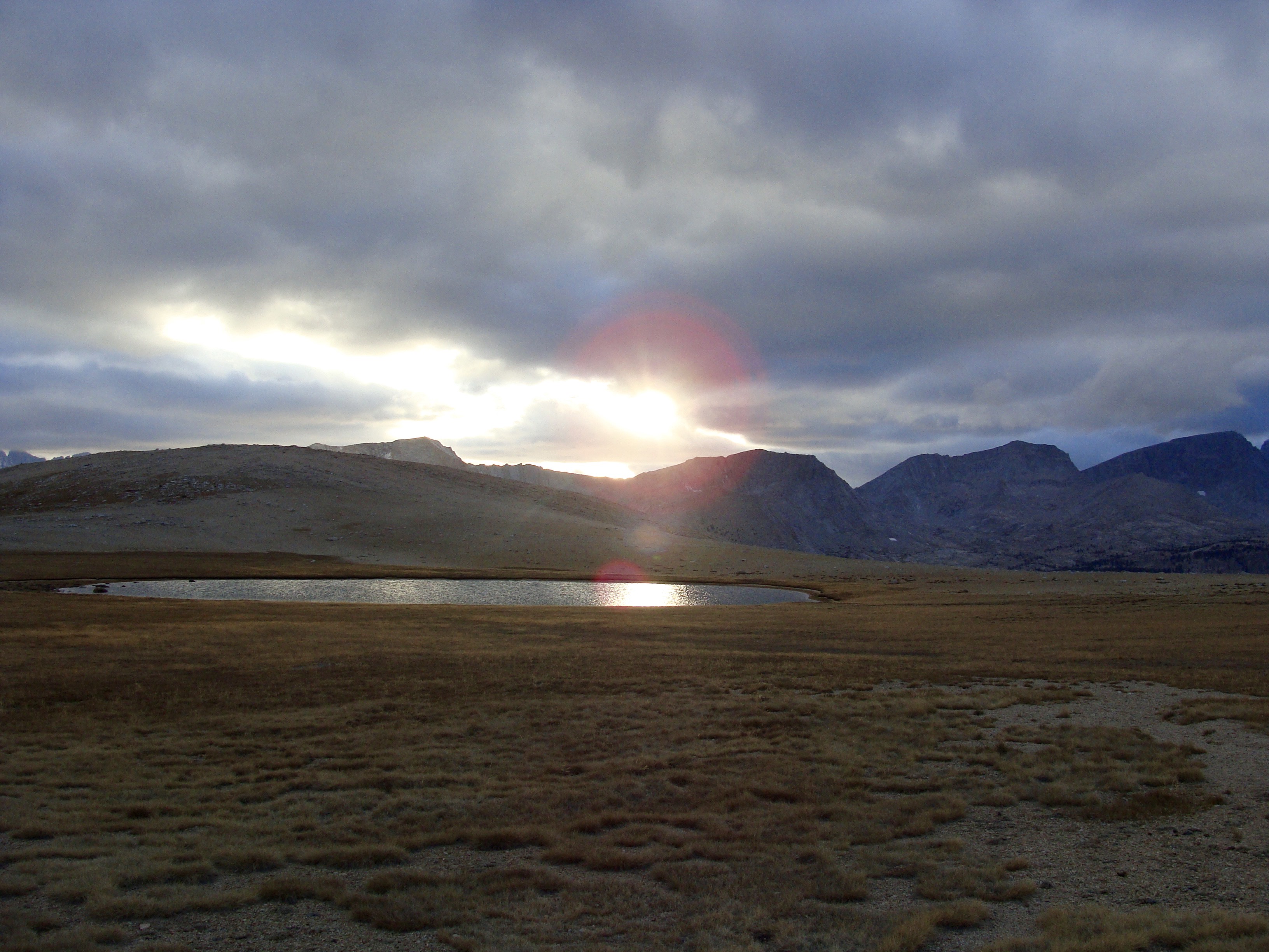
Stepping onto the southern aspect of Forester Pass, the storm miraculously dissolved. I only had to down-climb a few hundred feet before the clouds lifted entirely, exposing a miraculous valley below, teeming with life. The drop-offs from the trail’s edge provoked intense vertigo. Another chain of high altitude lakes leap-frogged down the canyon as far as the eyes could see, and spectacular grassy meadows stretched for miles in every direction. Dosed with adrenaline, I forgot the nagging pain in my foot and broke into the fasted stride I’d held since day two. The wind was raging hard, but with the afternoon daylight reflecting off my wind shell I was as warm as could be. 198…. 199… 200 miles! I flew right past my intended camp for that evening, dead-set on squeezing every last minute of light from the sky. I passed another vacated ranger station, climbed through another burnt young forest and topped out on the Bighorn Plateau. The scene from the plateau was as serene as I’d ever experienced in the backcountry. To the west, a glowing orange sun faded away against a backdrop of behemoth 14,000 foot peaks. Trail-side was a small, landlocked pool no wider than ten yards, reflecting the views of sunset into the lens of my camera. A slight breeze ruffled my hair and stirred a sea of waist high alpine shrubbery into a rhythmic dance. The trail ahead was, for the first time since I left Yosemite, truly flat, with soft, supportive dirt underfoot. I stopped here for a long pause, admiring the intense yet peaceful, divine nature of the moment. I was home in the Sierras.
Day Eight (Crabtree Meadows to Whitney Portal — 16.6 miles)
I can only describe the landscape as life altering, in the most humbling fashion.
I clicked the top button on my headlamp repeatedly… no dice. The beam had been dimming the past few mornings, a sign of sure battery shortage, but I had forgotten to pick up spares in Yosemite. I would be walking in the dark. I reached for my food bag, which was now the size of a young cantaloupe, maybe a mango. Inside were two oat pastries (one for breakfast), the equivalent of three dark chocolate bars mismatched and broken in pieces, two scant scrapings of peanut butter (also for breakfast), and a handful of pumpkin seeds. I was going to be in dire need of a meal when I hit Whitney Portal. I crept out of camp sometime long before sunrise, marching cautiously by only moonlight through an empty, and very frozen Sierra wilderness. I camped along Wright Creek the night before, so at least I had a full cache of water. I passed another vacant ranger station, Crabtree, with no signs of life. I could only imagine what it’d be like to hike the JMT in the summer, when the ranger stations are staffed, Muir Ranch, Vermilion Valley Resort and Reds Meadow are providing showers, hot food and cold beverages, and campsites are full with weekenders and thru-hikers alike… when the trail isn’t obscured by snow and you can wake up, roll out of bed and make breakfast under a warm sunny sky. The JMT experiences I read about seemed like an alternate universe from where my frozen feet and battered body stood, alone in the woods.


At the shores of Guitar Lake I watched the sun break the blackness accompanied by powerful winds. As I rounded the opposite shore I noticed one singular tent perched on the edge of the remarkably “guitar-like” lake, thoroughly entrenched in snow. Whomever was inside was much saner than I, and was probably still sleeping comfortably in a gigantic, fluffy sleeping bag. I, on the other-hand, was halfway up the final 4,500 foot push to the summit of the tallest peak in the continental United States, despite a mounting wind storm. The trail was surprisingly gentler than Glen and Forester Pass, but the wind chill was piercingly frigid. Hidden in a cave, I ate all my food besides the few hunks of chocolate. I didn’t want to leave my shelter, but the summit of Whitney wasn’t getting any closer, and I needed to make it to the trailhead before dark.
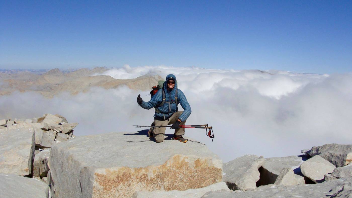
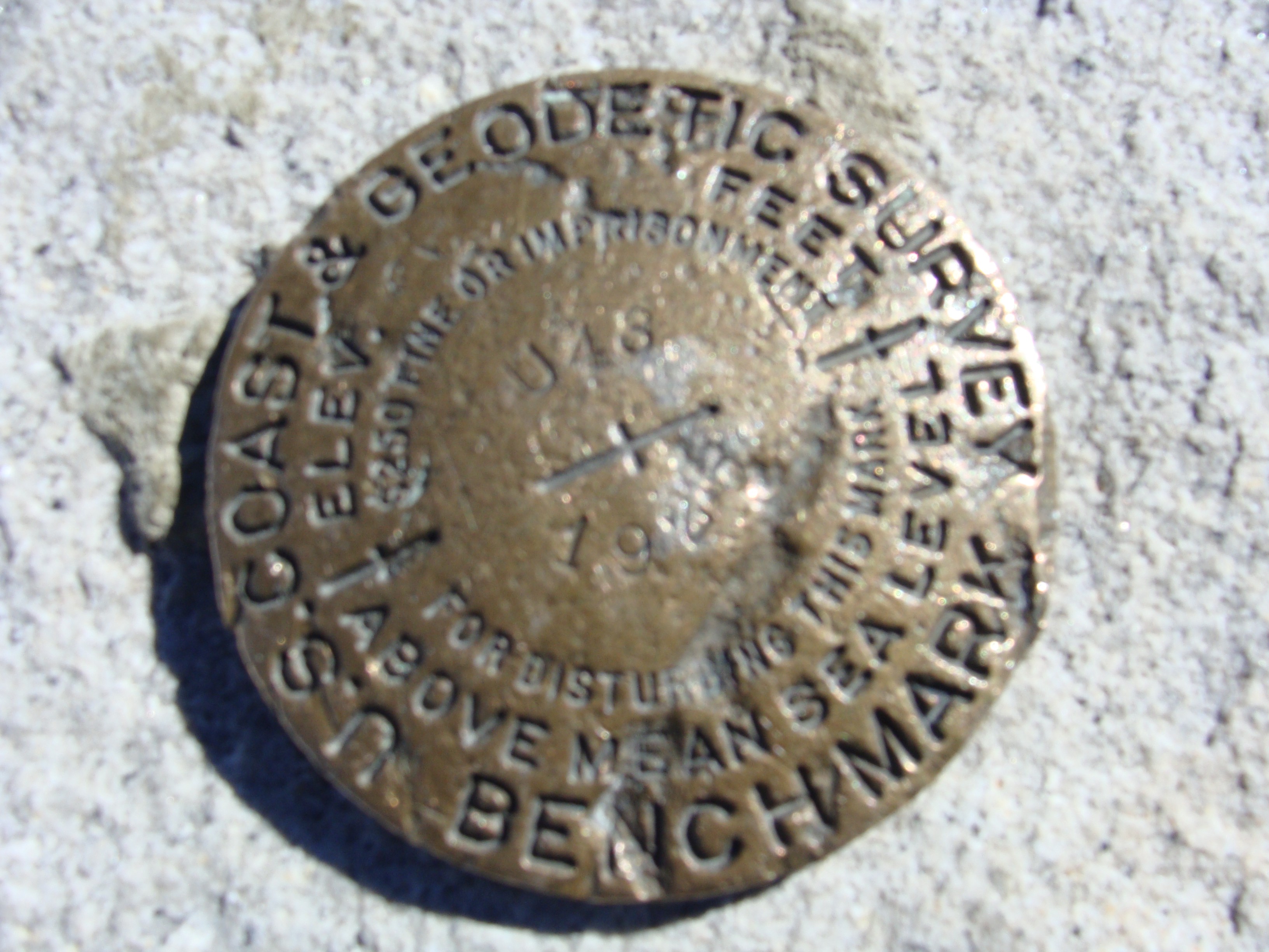
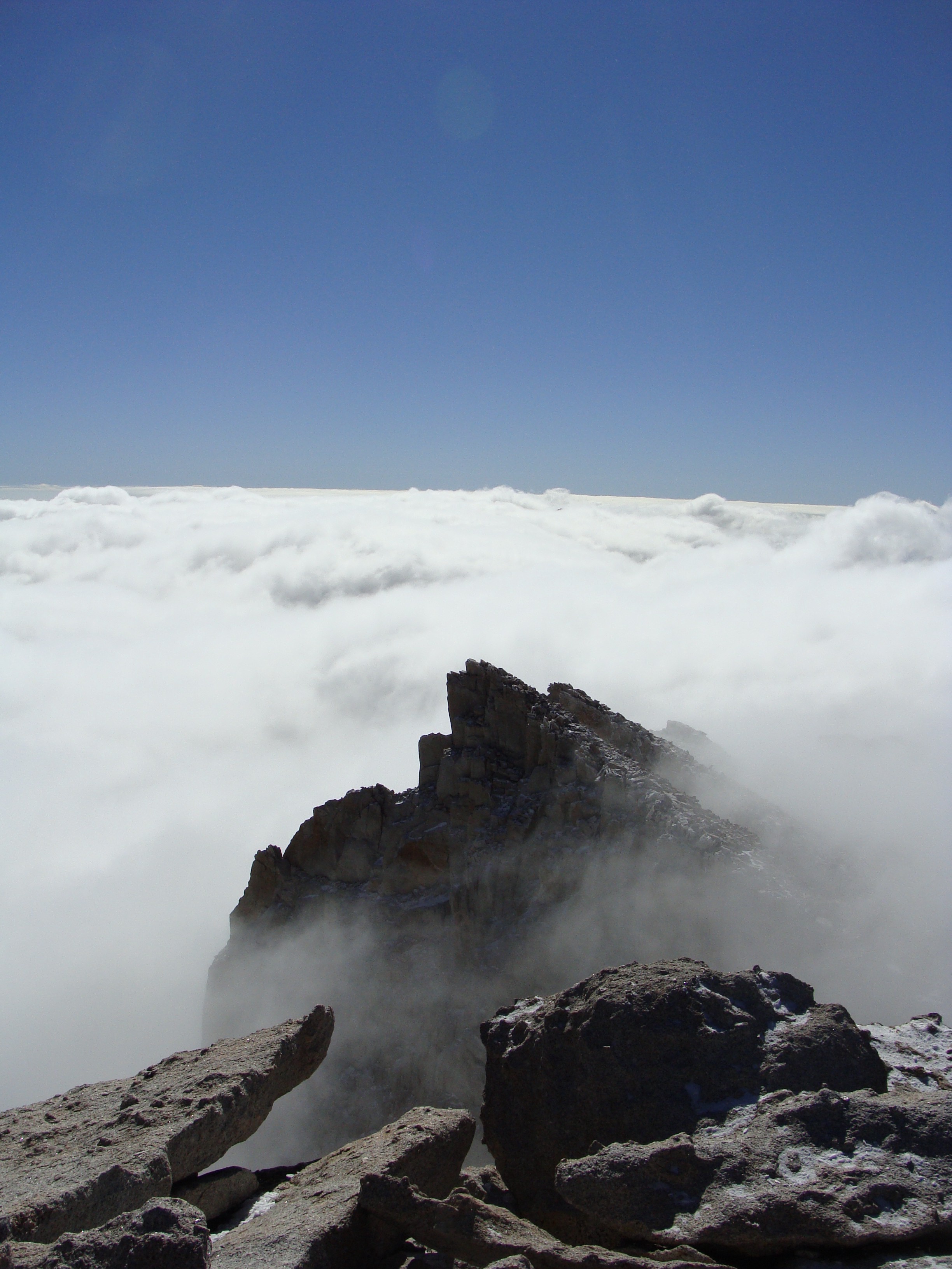
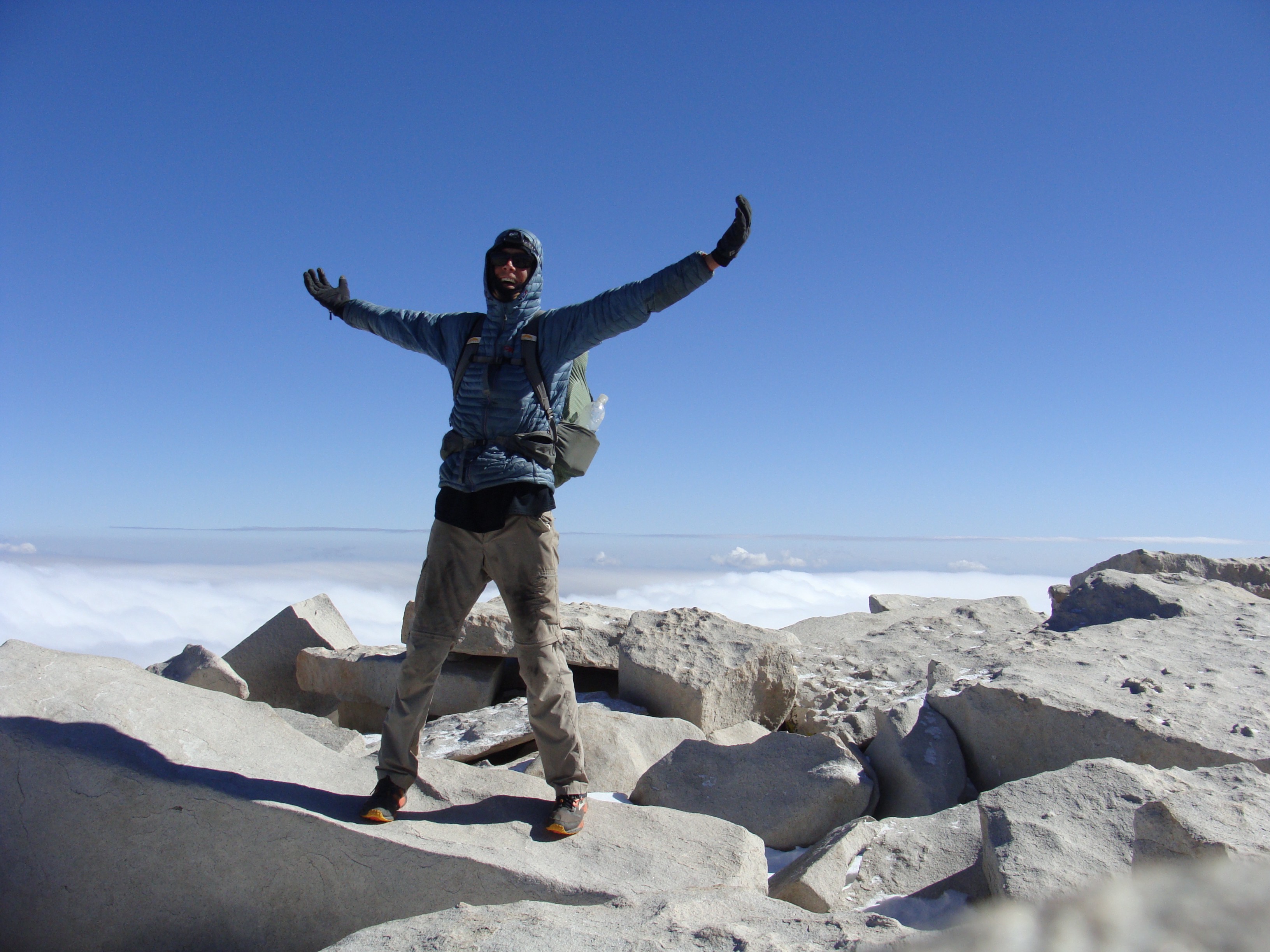
Trail Crest is the name for the pass abutting Mount Whitney. The summit of Trail Crest is 13,404 feet, from which a spur trail follows a high ridge for just over one mile to the summit of Whitney. I would ascend and descend this same trail, before climbing down the other side to the town of Whitney Portal — where hopefully my mother would be waiting. I only made one phone call to her atop Donohue Pass, for my phone died shortly after. Back in Idaho, we had arranged a Saturday rendezvous by dark; I just had to trust she would be there. By the time I made it to Trail Crest, I was suspended in another cloud of dense fog. A storm had rolled in, bringing light snow and obscuring my view of Whitney. A few inches of fresh snow accumulated overnight, but much to my surprise, a decent collection of footprints already blazed the way, coming from the opposite side of the mountain. The summit ridge of Mount Whitney is a micro-mountaineering adventure in early winter. Steep faces covered in snow made for slow, technical travel. Luckily I was nearly to base weight (pack weight without food, water or fuel), and I dropped to my hands and knees with ease to negotiate the precarious sections. The whole time I approached the summit, I couldn’t help but be disappointed in the weather. I couldn’t bear the idea of not having a world class view from the top of Whitney. As I came off the ridge and began a switchbacking stretch that would ultimately be my last, blue skies began to appear overhead. I climbed higher, and with each step the fog thinned. Eventually a crystal clear sky manifested, and intense rays of sun began to burn off the clouds. I rose above the cloud layer as if peaking my head from a city storm drain, and the whole world — literally the whole world — came into focus. Ten minutes later I was standing at the survey hut atop the tallest mountain in the contiguous United States of America. I can only describe the landscape as life altering, in the most humbling fashion. For as far as the eye could see, brown rocky peaks broke through a sea of grey clouds like shark fins in an ocean. I scrambled to the official summit marker and dropped to my knees. I made it. 210.5 miles — 7 days and 21 hours. The John Muir Trail was finally mine.

A Fresh Perspective
Reaching the summit of Mount Whitney truly paralleled the feeling I felt walking the final mile of the Appalachian Trail. Being bombarded with questions by a half-dozen other climbers brought into focus the magnitude of my John Muir Trail adventure. Their shocked expressions made me feel a little insane for ever starting, but also incredibly proud of my achievement. I thought back to the countless night miles, the freezing temperatures and the adversity my now blissfully numb ankle dealt me. The mental torment and sheer physical exhaustion. The more I talked, the crazier the stories began to sound.
From the summit, an 8000 vertical foot, 11 mile, knee-shredding descent guided me all the way to Whitney Portal. There was an incredible six inches of dense snow on the south side of Mount Whitney, enough that I was able to, in the words of a good friend from the Tetons, “boot-ski” a few sections. The Whitney Portal parking lot came into view from high up the canyon belly, and few excruciatingly painful hours later came the smiling face of my mother. She hiked up the first hundred yards to surprise me. I bid farewell to a new friend I made on the descent, and jumped into my mother’s outstretched arms. We dined in Whitney Portal, where I found a small Mexican restaurant for an aptly sized vegan burrito. After staying in a roadside motel, we made our way back to Little Yosemite Valley to retrieve my car. We enjoyed a short hike around Yosemite before packing my car for return to Idaho. I hadn’t yet time to process the adventure, but I knew I made it, and that much was enough for me. 7 days and 21 hours — 221.2 total miles — 47,000 feet of vertical gain — completely unsupported. “America’s most beautiful trail.” Mission Accomplished.

In the hours, days and weeks after reaching Whitney Portal, I found it harder than expected to re-acclimate into everyday life. It had only been eleven days since I’d left home in Teton Valley, but the JMT experience carried the emotional gravity of a lifetime. While the trek was easily the most intense week of my life, I was surprised by how little I wanted to talk about it. Do not misunderstand, having the entire John Muir Trail to myself in early winter was more magical than anything I could have ever wished for, but at the same time I felt like I’d been tossed into battle and just barely crawled out the other side. I was beaten down, not only physically (I later found out I tore ligaments in my ankle, most likely before starting) but emotionally. As jarred as my body and mind were though, I couldn’t be happier with my John Muir Trail experience. Somewhere deep inside me had a craving for adventure, and an adventure I certainly found. When I return to the “Range of Light” I look forward to experiencing the sights and sounds slowly, peacefully and quietly. If there’s anything that hiking 223 miles in 8 days across the Sierra Range taught me, it’s that the mountains of the Pacific are vast, wide and mysterious. In the grand spectrum of life, we humans are but a speck. An eternity of exploration wouldn’t even scratch the surface of this expansive wilderness’s intricacies. The best I can do is be grateful for the mere sliver I did see, and look forward to the next slice I can devour, whenever the opportunity arises.
“The mountains are calling… and I must go.”
John Muir
Thank you as always to all my friends, family and supporters, and to Icelantic Skis for supporting this website. Without your love none of my adventures would be possible.
Follow along on Instagram @brandon.wanthal.photography


That was such a riveting story! I couldn’t put it down. What an accomplishment!! You are an amazing person and I look forward to future tales of your adventures. Xoxo Laura
LikeLike
Thank you Laura! I’m glad you enjoyed it, it sure was a perception shifting experience for me. Talk soon XOXO
LikeLike
Hardcore! Nice read too
LikeLike
Thank you! “Hardcore” adventures become so much easier in such beautiful country 🙂 Are you eyeing up the trail?
LikeLike
Wow! That is an incredible story. My son and I backpacked the JMT in 2000 and 2002, but in August, over 30 days and with several resupply days. Yours sounds like a totally different experience!!!
LikeLike
Well, one day I hope to hike the JMT (perhaps as part of a PCT thru-hike) in a more modest fashion 🙂 After all, I probably walked 1/4 of the trail before dawn and after dusk! I’m sure you guys had a wonderful experience – perhaps with a bit less pain!
LikeLike
Sick story trying to plan out a 8 day jmt as well this helped alot
LikeLike
Awesome! A great way to experience the trail if you’re up to it.
LikeLike