Three days, three classic peaks and lines. The first of a three part series detailing an eight day ski mountaineering trip to the Pacific Northwest.

Shortly after knocking off a ski descent of Wyoming’s Grand Teton, a surge of 80 degree weather decimated the Teton snow-pack, leaving an uninspiring landscape of rocks, dirt and craggy peaks. Almost every Teton Valley skier conceded to running shoes and bicycles, but I wasn’t ready. Fueled by the best spring season of my lifetime, I began shifting my gaze to neighboring mountains in search of one more adventure. Montana’s Rockies? Too warm. California’s Sierra Range? Too dry. Colorado? Even if there was snow, I’ll pass. (Sorry Colorado, but you do have quite the crowd) Pacific Northwest? A little on the drier side… but…
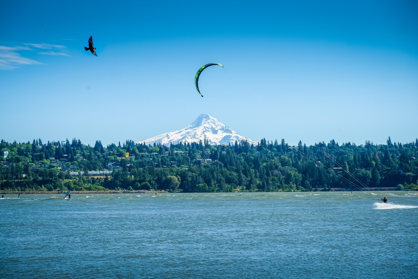
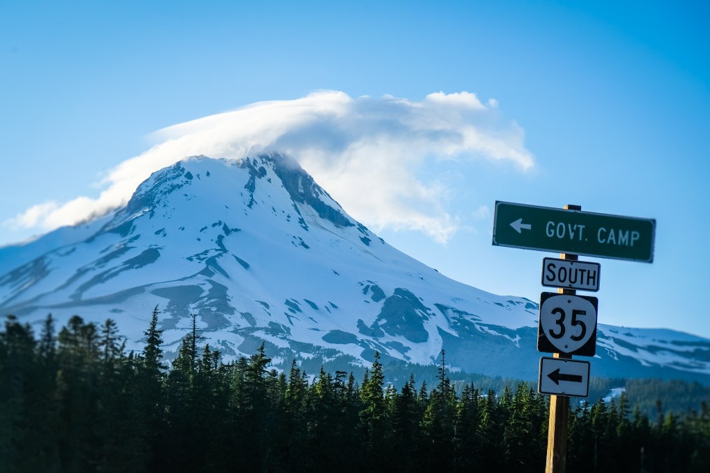
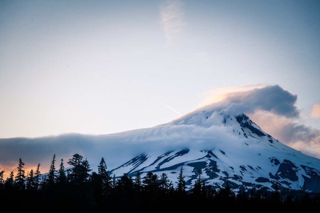
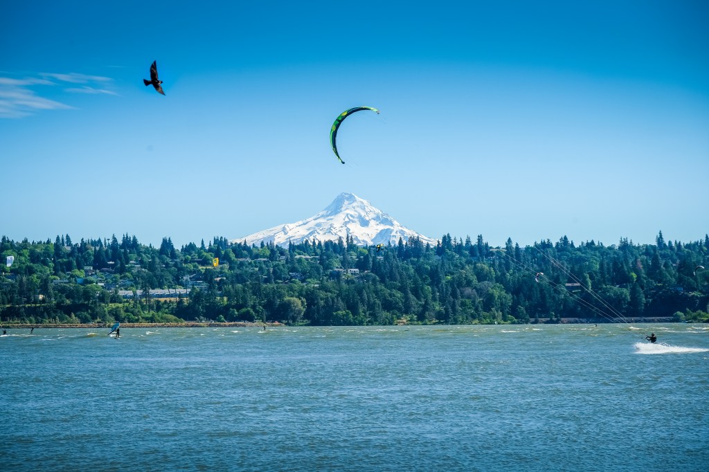
If there’s anywhere to pull off a slew of mid June skiing, it’s the Cascade Range. Known for their massive volcanoes, expansive glaciers and usually deep but always dense snow-pack, the Cascades stretch from Northern California well into Canada and are famous for a dedicated “turns all year” ski culture. Even on a low snow year, which it certainly was this year, the tallest and proudest of Pacific Northwest volcanoes remain well draped in white. Approaches may be longer, but if 2,000 feet of dry trail dissuades anyone from 6,000 feet of perfect corn skiing, I would put their skier card on probation. A hasty week of packing, sifting through trip reports and obtaining beta from friends and guidebooks alike brought me to the base of Oregon’s tallest peak, Mount Hood, with an eight day window to purge every last twinge of winter stoke from my bones.
Mount Hood – Newton-Clark Headwall
“The Newton-Clark Headwall (NCHW) has the most aesthetically enjoyable descent from the 11,239 foot summit of Mount Hood” claims the 50 Classic Ski Descents of North America; and if you’ve been following this blog for any time now, you may have noticed my slight obsession with this book, so naturally the NCHW starred the itinerary. Adding to the excitement, ’50 Classics’ also warns of a 55 degree, 500 foot pitch of sustained, no-fall skiing. “If a skier loses an edge or is caught in a slough, the hapless victim will be carried over 300 feet of rocks and dumped into the large crevasses of the Newton-Clark Glacier.” As someone who passionately pursues steep and iconic ski lines, the warning was mostly enticing with a sprinkle of fear, but certainly not enough fear to outweigh the appeal of tackling one of North America’s steepest lines.
I had a picture perfect view of the Newton-Clark Headwall from my camp on Bennet Pass, directly across from the Mount Hood Meadows ski area. The book certainly wasn’t lying. It was steep… steep… steep. However, I know better than to judge a route from the road, as nearly all mountains fall victim to an optical illusion that makes slopes look steeper when viewed from afar. After a lovely evening of hanging out with a Portland local and shooting the sunset alpenglow with my new Fujiflim XT-2 camera, I set an alarm for 4:00AM and curled into the trunk of my petite Hyundai Elantra.
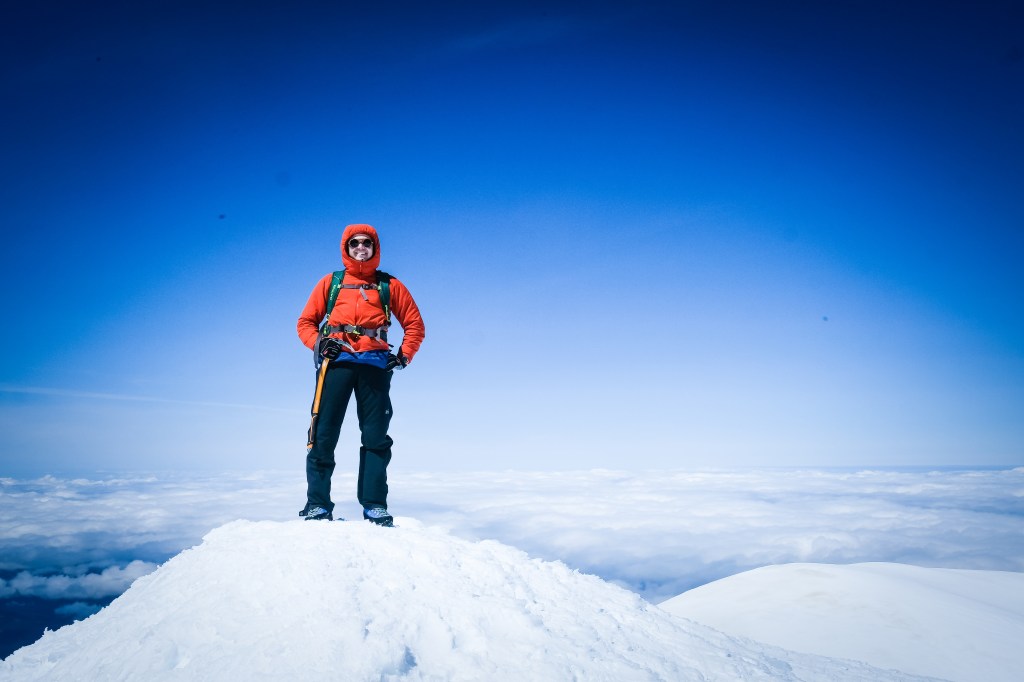
My approach started just after 6:00 from a very muddy Mount Hood Meadows base area. While lifts typically run well into summer, the COVID-19 pandemic spontaneously decapitated the season, leaving the parking lot and resort infrastructure a bare-bones scene of maintenance vehicles and abandoned chairlifts. With no snow in sight, I began my day trudging up service roads and winter trails until reaching the snowline about 1,000 feet above. As I would come to appreciate later on, climbing Cascade volcanoes is much more straightforward, both mentally and literally, than my home Tetons. Instead of connecting a multitude of canyons, couloirs and ridges to reach a pointy and often obscured summit, Mount Hood, as well as every other peak I would ski on this trip, showed its might loud and clear. Route finding absent, I watched the hours tick by as the Newton-Clark Glacier and my ascent route, the Wy’East Snowfield, caught their first glimpses of morning light. Following an old bootpack I kicked steps into the 40 degree Wy’East, meandering my way to the summit ridge without much trouble. Besides two skiers following a modest ways behind, I was alone on the world’s second-most climbed climbed mountain, a very rare experience. Opposite the Newton Clark was a guided party of six and one solo-skier on Mount Hood’s standard climbing climbing route, the South Crater. However, with Hood being so expansive, I wouldn’t see either party for the rest of the day. A short traverse climber’s right took me to the top of the Newton-Clark, where I stared skeptically at a precarious roll-over that seemed to drop endlessly into the abyss below. Having scouted the line from the car, I was confident of the route’s ski-ability, but nonetheless struggled to push the damning idea of tumbling over hidden cliffs from my mind. I arrived just after 9:00, and with the snow still plenty firm ditched my pack and attempted to climb the final short, rocky and definitely un-skiable pitch to the true summit. To my disappointment, the route wasn’t in proper shape for ascent without rope, partner and gear. The leftmost variant was ice glazed choss and the right solar mush (I plunged waist deep through unconsolidated snow just beneath the summit ridge), and with both offering highly consequential exposure I proudly swallowed ego for life. The crowning jewel of Mount Hood skiing was waiting just below, so no regrets harbored as I retreated to my skis and clicked in for the “most aesthetically enjoyable descent” on one of North America’s most famous volcanoes.
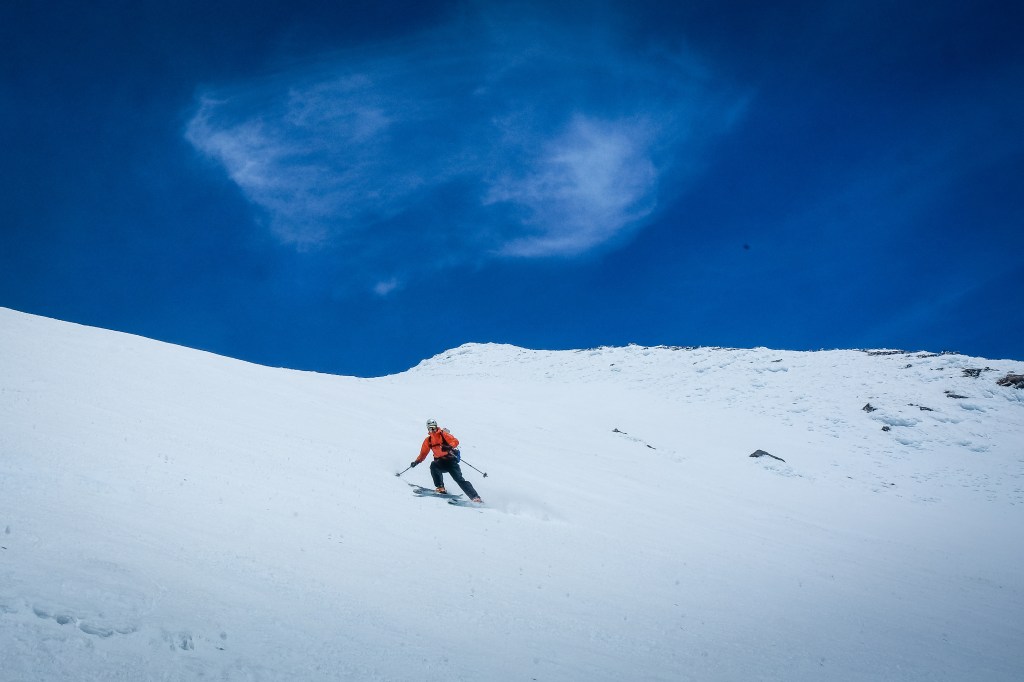
I made cautious turns on perfectly softened snow to the edge of the rollover where I was relieved to see an open snowfield free of obstructions. However, the sheer angle alone was enough to make my stomach drop, and as I jumped into my first turn it literally did. Slough management exacerbated the pucker factor as rivers of dense snow ripped down the head-wall with every turn, trying to sweep out my skis. I worked my way across the face a series of times, stopping when necessary to allow the slough to pass. With the left side runnelled by rockfall I stuck mostly to skier’s right, negotiating the steeps without incident and traversing on old tracks to the perfectly corned apron below. Off the gnar and safe from crevasses, it was a care free joy ride to the Wy’East Snowfield where I scored multiple thousands of feet of perfect summer turns above the ski area. By this point, scores of locals had assembled on the lower mountain, watching skiers above and enjoying their own more relaxed turns. I indulged in the social camaraderie, stopping to talk with a few groups and eventually following the two Wy’East skiers from earlier down a narrow strip of mushy white potatoes to the parking lot. I wish I’d found the continuous snow on my ascent, but nonetheless, a seamless first day in the Pacific Northwest was all I could’ve asked for.
Mount Adams – Southwest Chutes
Following advice from an old PNW friend, I directed my sights away from classic lines and headed north to attempt the Southwest Chutes on Mount Adams, a two hour drive from Mount Hood. “35 for 35” Bellingham, Washington guru Mike Cohen told me, referring to a 35 degree sustained slope for 3,500 feet. I couldn’t help but scoff, lines like that just don’t exist in the Tetons. A short shuttle across the Colombia River Gorge and up into the Mount Adams Wilderness took me to the “South Climb” trailhead, where I was greeted by at least a dozen cars spending the night. I wouldn’t be alone on this journey, and based on my view from the town of Trout Lake, it wasn’t hard to see why.
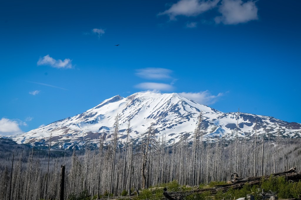
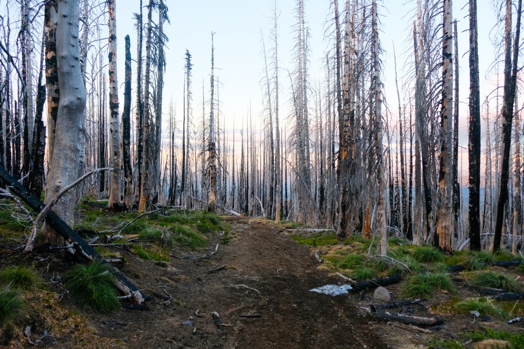
There was an excited energy in the parking lot when my alarm went off at 3:30. Headlamps bobbed about like lightning bugs on a summer night, stoves fired all around and car doors shut rhythmically as many skiers prepared for the arduous 7,700 foot vertical trek. Just after 5:00 I set off from the trailhead, choosing ski boots over approach shoes for the one mile hike to the snowline. The sun rose through a matchstick obstruction of freshly charred forest, exposing a pastel array of soft pink and orange tones. Another beautiful day in the Pacific Northwest was well underway.
A traditional climb of Adams can be broken into three sections characterized by three distinct landmarks, the Lunch Counter (10,000 feet), Pikers Peak (false summit, 11,555 feet) and the true summit of Mount Adams (12,220 feet). Climbers have two choices for routes to the Lunch Counter, after which all paths head directly up the southern ridge. Though gunning for the more direct “winter route” to the Lunch Counter, I found myself quickly lost in a haze of excitement, climbing far too high on the standard trail to access my intended line. Instead of backtracking, I joined forces with a local skier from Eugene, Oregon and proceeded along the “summer” route, which was appealingly simple and intuitive. Rich, a Denali climber, well seasoned mountaineer and newly appointed father, nursing a bum shoulder and trekking with one pole, made for excellent conversation as we wound our way up the endless network of icy snowfields. One day I aspire to ski Alaska’s Mount Denali, and though Rich hadn’t skied from the summit, I enjoyed extracting as much information and expertise as possible. True sunrise had unfolded by the time we crested the Lunch Counter, exposing at least a dozen other skiers in our wake. Pursuing a solitary summit, the congestion inspired me to move faster, leaving Rich, who was only heading to the top of Pikers, behind.
Pikers came and Pikers went with a tiring, multi-hour, ski-crampon assisted climb of the steep southern snowfield. Like Hood, I was far ahead of schedule to the top of my ski line, which began from the false summit. A harrowing ridge-top wind encouraged no haste, so I continued obediently for the 12,220 foot Mount Adams proper. I completed the straight-forward, non-technical ascent just before the five hour mark, scoring tremendous panoramic views of Mount Rainier to the north, Hood to the south, Mount Saint Helens to the west and the vast expanse of the Cascade Range all around. Joined by one other non-skiing mountaineer from Bellingham, Washington, I soaked in the scene beneath a conveniently placed cornice that provided partial shelter from the bone-chilling westerly winds.
Ushered off the summit by worsening winds that threatened my extremities, I traded the prospect of corn snow for thermal relief with a 700 foot chunky ski of re-frozen debris and peppery rocks that rattled my knees to no end. Even in the poorest of conditions, skiing off the summit of a twelve thousand foot volcano felt absolutely amazing, and although they certainly weren’t graceful, my turns felt precise and safe. I traversed back to the summit of Pikers just as the whole gamete of Adams attempters crested the ridge. Because of the wind, snow conditions weren’t cooperating much on the lower mountain either. At least six other skiers were camped beneath a rock outcropping waiting for softening, and as time went on only more amassed. I happily took shelter with Rich, who was also waiting for a hopeful corn harvest. I couldn’t help but laugh at the scene, I’d never been around so many people so high in the mountains, and this particular Adams crew took all shapes and sizes. Everyone from speedy solo mountaineers to aspiring skiers with clunky gear and cotton flannels donned the slopes of Pikers, creating quite the spectacle. As our wait dragged on most of the adventurers folded, opting for the safer ascent route, and many forgoing the summit altogether. With the one hour resting mark far behind, Rich and I agreed to ski by 12:45, no matter the conditions. The Southwest Chutes are steep, but nothing like Hood’s Newton-Clark. Even if an upper stretch of bulletproof ice had to be endured, I figured we could safely hack our way to good corn below; and safely hack our way to good corn we did.
We were the first pair to drop into the Southwest Chutes that da, and as such, were the first to score tremendous turns on the famous face after surviving a thousand feet of “Vermont-esque” chunder. Just as I’d expected, the snow promptly softened at the wind-line, allowing for an epic indulgence in aesthetic, never ending, fall-line corn skiing. For a self-proclaimed “not the best” skier, Rich looked right at home in the summer snow as the two of us finished off the Southwest Chutes in proper style. Off the goods and into the inevitable slop, a stout two hours of monkeying over melted out gullies brought us back to the approach trail with another crew trailing shortly behind. The temperature difference between the base and summit was remarkable; down here I could’ve benefited from a virgin margarita and a beach chair. While the margarita never quite materialized, an ice-cold Spindrift Seltzer accompanied by open faced cucumber and tofu pate sandwiches sure hit the apres-ski spot, especially in the company of other starving but incredibly stoked skiers.
Middle Sister – North Face
Leaving Adams with head full of inspiration, I was dismayed to see the weather window closing rapidly on the Pacific Northwest. Friday’s forecast beckoned clouds, high winds and potential snow in the Colombia Gorge area, questioning the viability of a third ski objective. Ready to concede, a last minute phone call to Bryce, a local guide I met at the base of Mount Hood, sparked a glimmer of possibility. He had a quirky line on the North Sister, a lesser known Cascade Volcano in central Oregon, in mind. Though the last thing I wanted to do was drive another minute, let alone four hours on mountainous roads through the middle of the night, partly sunny skies and a motivated partner pushed me over the edge. On to the Three Sisters Wilderness I went.
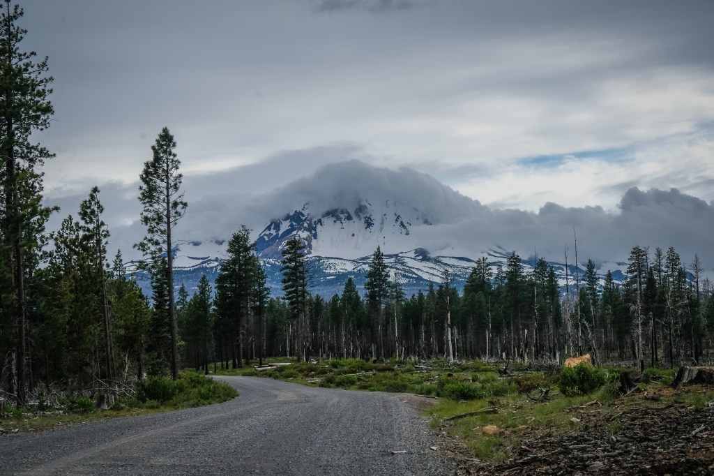
We both arrived at the Pole Creek Trailhead shortly after 1:00 AM, so when my 4:30 alarm sounded all I could do was cringe. With 13,000 feet of climbing in the bank and the dead-weight of sleep deprivation counteracting my morning coffee, I was happy to follow an equally sluggish Bryce up the five-ish mile approach trail. Just like Adams, the Three Sisters area had recently burned, an eerie sight beneath dark clouds congregating overhead. The further we trekked the less convinced I became of our ski objective. Not only were these southern peaks much less covered, a product of both elevation and lesser weather patterns, but without the sun we’d most certainly be skiing on ice. Left to my own devices I definitely would have surrendered, but Bryce seemed determined to forge on, and I obliged.
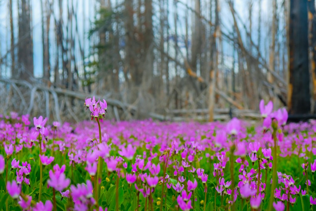
A patch of Henderson’s Shooting Stars blooming from an ashy patch 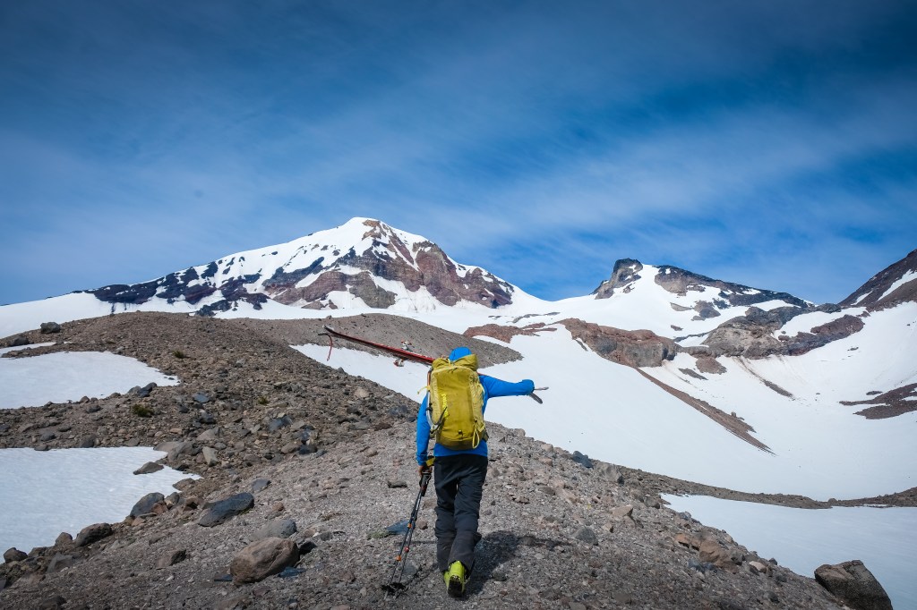
In this rare instance, dirt travel was more efficient than snow!
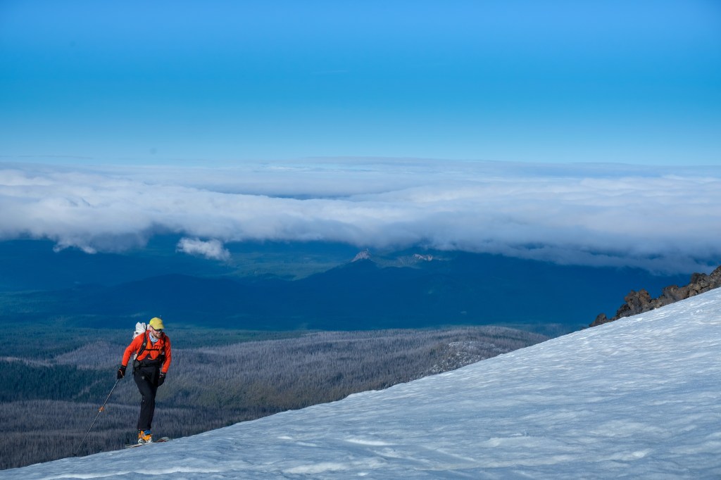
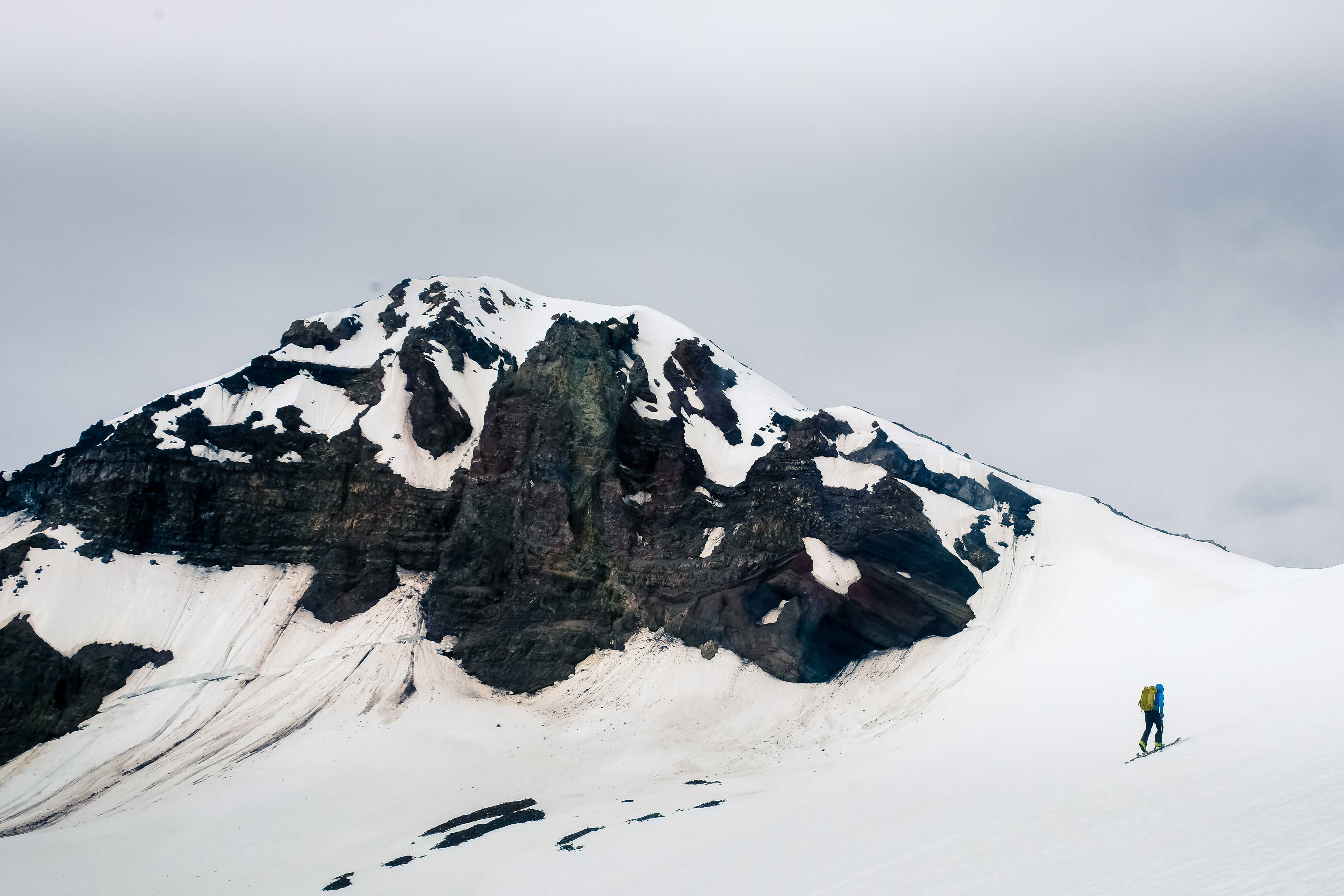
The clouds broke just as I was really starting to fear for wasted time, exposing a bright summer sun in a matter of minutes. A resurgence of energy flooded my body, and together we transitioned to skins and began our push into the alpine basin bridging the Three Sisters. Although smaller in magnitude, the triad of volcanic peaks struck a certain chord within me; they were absolutely beautiful. Bryce claimed this was one of his favorite places in the Pacific Northwest. The combination of aesthetic ski lines on a variety of aspects and the clear lack of crowding reminded me of the remote reaches of Idaho. Although our original goal for the day, a steep, bottle-neck style couloir on the eastern aspect of the North Sister, was clearly a few weeks removed from ski-able condition, the Middle Sister (10,046 feet) just to the south screamed to us loud and clear. The king line on the east face was melted out as well, but the typical ascent ridge looked plenty filled in for a true mountaineering descent. Propelled by central Oregon lore we continued directly up the basin to the obvious saddle and switched to crampons for the short but worthy North Ridge climb.
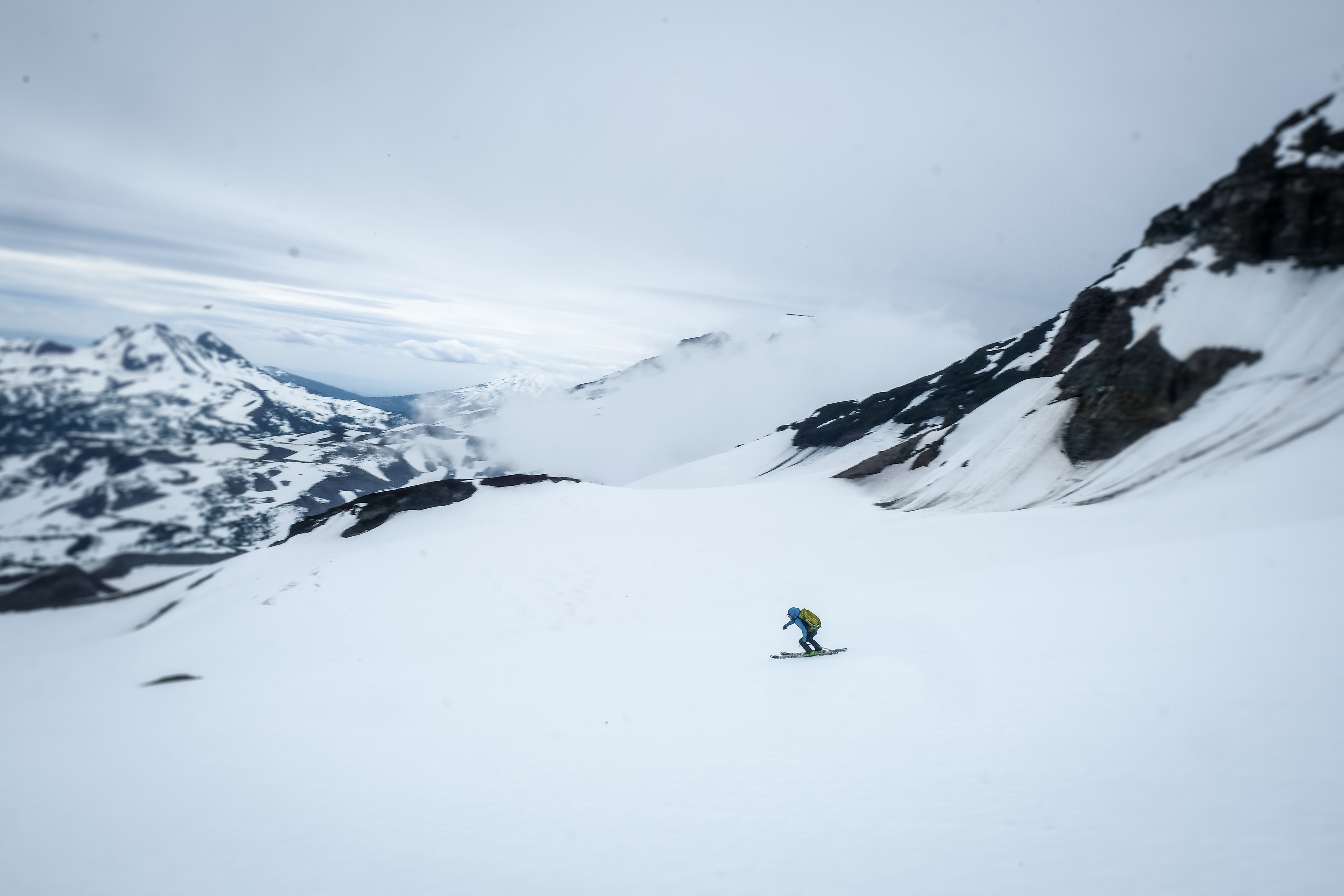
Topping out on the Middle Sister was a unique experience. Four other prominent volcanic peaks stood in close proximity, and a strong wind coupled with newly clouded skies added an air of suspense. Haunted by injury for the last eight months, Bryce’s enthusiasm alone was enough to distract me from our unfavorable ski descent ahead. His gratitude shone loud and clear, setting the tone for a fiasco of technical jump turns on icy terrain. In good conditions, the north face of the Middle Sister would be a tremendous descent, but for us it was a delicate game of “don’t fall” and “slow n’ steady.” Growing up on the East Coast, conditions like these are common fare, so while I’m never excited to tackle a firm head-wall, I also never feel out of my element. With the steep pitches behind us, we re-grouped at the saddle and continued to mob a steady 2,000 feet of sun-softened corn back to our tracks below. Dipping and diving off ridges and jibbing any feature we could find, the low-angle terrain of the Three Sisters basin transported me to memories of closing day resort skiing, warm, free-flowing and carefree as can be.

After a succession of micro rain storms and a few hours of meandering around in the woods we arrived back at camp desperate for nourishment. As a former long-time vegetarian, Bryce had no problem whipping up a vegan feast of pinto beans, veggies, guacamole and rice in the back of his fully stocked camper van, complete with warm corn tortillas and hot tea. It was only 4:00 PM, but the evening light was already closing in. Two more days of forecasted storms left an opportunity to re-group and strategize for the next window of dry weather. As Bryce departed for his home in Hood River, I was left with a beautiful emptiness. Baker? Shasta? Sierras? Sawtooths? With a week’s worth of time, a tank full of gas and pair of Icelantic Natural 101’s in the trunk, really, what isn’t on the menu?
(Stay tuned for part two!)
A Spiritual Take
Be the master of your own destiny, sometimes. Or in less circuitous terms, go with the flow. Or, in terms of this specific experience, follow the locals! My entire Pacific Northwest experience, especially the first half, was shaped by the locals I both knew beforehand and encountered along the way. Before leaving Idaho, I took a fixed agenda to Washington local Mike Cohen, who discarded half my itinerary for more seasonally appropriate objectives. The Southwest Chutes on Adams were his brainchild, and boy was I glad I listened. Furthermore, the decision to follow Bryce to central Oregon proved the trip’s hidden gem. Had I stuck to my guns I would have been warring with torrential winds on a second summit attempt of Mount Hood, or simply hiding from a torrential rainstorm in Hood River. Whenever you travel, no matter the discipline, I recommend malleability and openness. I wouldn’t let somebody give me a tour of my own home. Why? Well… they wouldn’t know where the peanut butter jar hides! Mike and Bryce knew exactly where to find the peanut butter, and since I didn’t try to find it myself, I got to indulge in a delicious treat! Weird metaphors aside, I made a few friends too!
Resources and Beta:
I didn’t provide nearly as much technical data as usual. Below are some resources I used to plan my trip and my rough personal data for each route:
Newton-Clark Headwall/Mount Hood:
- Round Trip Distance: 9 miles (from Mt. Hood Meadows)
- Round Trip Time: 5-7 hours
- Summit Elevation (NCHW) : Approximately 11,100 feet
- Elevation Gain: 6,000 feet
- Map Used: National Geographic – Mount Hood
- Additional Resources:
- http://mountainjourney.com/newton-clark-headwall-mount-hood/
Mount Adams:
- Round Trip Distance: 14 miles
- Round Trip Time: 7-8 hours
- Summit Elevation: 12,220 feet
- Elevation Gain: 6,700 feet
- Map Used: USFS “Mt. Adams Ranger District”
- Additional Resources:
Middle Sister:
- Round Trip Distance: 13 Miles
- Round Trip Time: 10 hours
- Summit Elevation: 10,045 feet
- Elevation Gain: 5,100 feet
- Map Used: N/A
- Additional Resources:
***all round trip distances, summit elevations and elevation gains are taken from http://www.skimountaineer.com/
Ten Thousand Too Far is supported by Icelantic Skis, Range Meal Bars and Black Diamond Equipment.
Ten Thousand Too Far is also supported by reader donations. If you’ve used this website to plan an epic adventure, consider kicking in a few bucks. The hours spent writing these articles are fueled solely by the desire to enhance our vertical community.
And if you would like to get updates on new content, enter your email below – no spam ever.


DISCLAIMER
Ski mountaineering, rock climbing, ice climbing and all other forms of mountain recreation are inherently dangerous. Should you decide to attempt anything you read about in this article, you are doing so at your own risk! This article is written to the best possible level of accuracy and detail, but I am only human – information could be presented wrong. Furthermore, conditions in the mountains are subject to change at any time. Ten Thousand Too Far and Brandon Wanthal are not liable for any actions or repercussions acted upon or suffered from the result of this article’s reading.
