
Come April, May, and June in North America, reliable weather forecasts for ski mountaineering are fickle, and the parameters for good ski conditions tighten. Here’s my strategy for planning a great day out.
We’re trying something new here – this is not a trip report! Instead, while pouring over the weather for an upcoming ski trip, I thought I would share my strategy for spring weather forecasting I’ve refined over the past couple of seasons. I would love to know your thoughts (including your springtime weather strategies), and whether this style of content is appealing. Stay stoked – it’s good out there.
Let’s get this out of the way: I’m not a meteorologist. What I am is a dedicated ski mountaineer that enjoys sliding on steep snow surfaces into early June each season. I live in the Greater Yellowstone Ecosystem, where a deep snowpack increases the incentive for late season skiing. When the stars align, it can be just as good, or better, than stable winter powder. Typically I am seeking sun-softened, blissful, “corn snow” conditions on solar aspects – east, south, and west faces. With stable high pressure and moderate temperatures, sheltered north faces will harbor powder beyond imagination, and gradually transition to “chalk” – thermally condensed and recrystallized powder which can supersede cold powder for steep jump turns. However, a little too much wind, or thin veil of cloud cover, can ruin a glorious corn descent faster than pouring ketchup in a banana smoothie. A few days of north wind or high ambient temps can render north faces breakable, bulletproof or anything in between. A cold swing coupled with low pressure can momentarily transport the mountains back to February. And obviously, the king of all variables is the overnight freeze. If the snowpack does not receive a solid freeze, all bets are off. For enjoyable and safe backcountry skiing, the mountains need to freeze – period. And believe it or not, getting a good freeze is more complex than air temperature alone. Several factors including cloud cover, wind, conductive heating and snowpack depth can produce freezes with air temps as high as 40 degrees, or non-freezes with temps as low as 25 degrees. Last but not least, we have the ultimate X factor: the Spring Predictability Barrier.
What is the Spring Predictability Barrier? It’s a professionally recognized phenomenon involving pressure, warming air masses, and all sorts of other meteorology witchcraft that “explains” why weather forecasts in the spring are often unreliable. You can read about it here. In laymen terms, spring storms have more energy and volatility, making them harder to accurately predict. In the winter, I can check one weather forecast on Thursday morning, pack my bags, and know what to expect when I click into my skis Friday morning. I can reliably plan a multi-day trip a week in advance. All weather models basically agree. By spring, this degree of nonchalance is punished. Over ten years and dozens of botched spring descents, I’ve become a forced weather obsessionist. Before an important mission I can lose hours checking weather models over many days, and if I’m unlucky enough to be skiing in an area with cellphone reception, I’ll often be checking models on fly. While this level of neurosis is painstaking, it’s a necessary evil – especially when skiing higher consequence lines, trying to squeeze trips between storm cycles, or decide whether to set an alarm for the dreaded 1:00AM wake up.
What weather patterns make for optimal springtime ski conditions is beyond the scope of this article. Perhaps I’ll write about that next. Instead, I’m going to dive deep into my weather forecasting strategy. From October through March, I use a NOAA point forecast for all my weather needs. Their comprehensive yet not to granular, and easy to read model rarely disappoints. But come April, for missions I really care about, I use a triple helix of forecasts from NOAA, Mountain Forecast and Spot WX. I take data from all three into consideration and use a mental average as my predictor for the day. Below I will briefly dive into how I use each one.

The King – NOAA
NOAA stands for the National Oceanographic and Atmospheric Administration. In my opinion, it is the king of all forecasts. If I only have time to check one forecast, I use NOAA. And because of it’s streamlined use and readability, it’s always my first check. If the NOAA forecast looks rock solid, I often won’t bother with Mountain Forecast or Spot WX.
How I use it
For the Teton Range, I type “NOAA GTNP” into Google. The first link that pops up will be a point forecast for 11,600 feet, centered roughly over the Grand Teton. If I am traveling to a new area, say the Sawtooth Range, I would type in “NOAA Sawtooth Range”. To the right of (or beneath) the general day-by-day text forecast will be a digital map. This map will highlight the forecast area. Below the map will be coordinates and an average elevation for the forecast model. The stated elevation represents the average elevation across the forecast area (highlighted zone on the map, in green). Clicking on the digital map will move the model, producing different forecasts and elevations. If I am skiing on Mount Moran, I will scroll up and click roughly on the summit of Mount Moran. If I want to check weather at the trailhead, I will then click somewhere in the Jackson Hole valley. To dive deeper, NOAA provides hourly forecasts for 48-72 hours. These can be accessed by clicking “Hourly Weather Forecast” below the standard readable text and map. The hourly forecast provides models for sky cover, air temperature, humidity, precipitation likelihood and amount, thunder, wind speed, and just about any other metric desirable.
Second Step – Mountain Forecast
I don’t love Mountain Forecast, but many people do. Their model is the most precise, providing 2-4 forecasts for every major peak in North America at different elevation bands, with a morning, afternoon, and night time-stamp. On Mountain Forecast you can check the weather at summit, mid-elevation and base of a peak, which would be a game changing tool if it were accurate. That said, the more precise a weather model becomes, the more variable it also becomes. In my opinion, Mountain Forecast provides the most utility when corroborating a shifting forecast from NOAA. I take it with seven grains of salt, but it’s so easily checked and understood that I think it’s worth a peek. If Mountain Project and NOAA agree, that’s enough for me. If they disagree, I move on to step three.
How I use it
Go to https://www.mountain-forecast.com/ and enter the peak you will be skiing on. If you are skiing in a less prominent or more remote range, the exact destination peak may not be covered, forcing you to use the closest adjacent one. The website is very intuitive and user friendly.
Third Step – Spot WX
Realistically, if you need three forecasts you should consider staying home. However, I hate staying home. Spot WX is your ticket to rationalizing a questionable adventure. It is the ultimate nerd forecast, offering several different models from both Canadian and American forecasting centers, and every imaginable weather metric down to the minute. If you think Elon Musk’s AI is sabotaging your ski day by trying to make you work instead, maybe you’ll like the Canadian models. The only downside I can find is an inability to get a high elevation forecast. Much like NOAA, as you click around on a digital map to display different models, Spot WX will show you the average elevation of each model. Even when I intentionally click on the summit of the 13,775 foot Grand Teton, I can never seem to produce an average elevation higher than 10,000 feet. I use Spot WX when NOAA and Mountain Forecast are at odds. Amidst the diciest weather, it’s my ultimate decider.
How I use it
Go to https://spotwx.com/ and find your location on the user friendly digital map. Several available models will be presented in a clean chart. In the info column for each model, it will tell you the duration (hours or days) and resolution (kilometers) of the model. The shorter the duration, the more specific the model. The shorter the resolution, the more specific, but also volatile, the model. The shortest resolution models will have the most accurate elevation for your chosen point. I like to poke around at a few different models and look for a general pattern. After clicking on a model, the units can be changed from metric to US standard by clicking on “change units” in the upper right corner of the screen.
The Ultimate Choice
After sifting through NOAA, Mountain Forecast, and the many models available on Spot WX, my brain is so polluted with weather information I’m typically teetering on the brink of crippling decision fatigue. Fortunately, I now have all the available information to choose between two great options. If the general trend between all forecasts points towards terrible skiing, I rest peacefully and focus on recovering for the next big day. If the trend points towards go-time, or I just feel like being impulsive, then I get psyched up for a long day in the hills. Ultimately, the Spring Predictability Barrier has the final say. If there’s one thing I’ve learned over the past ten years of ski mountaineering, it’s this: the more I ski the less I know. Good luck.
Love Ten Thousand Too Far? Find the information useful? Support independent mountain journalism with $5.10 per month through Patreon (and receive extra bonus content), or with a one-time donation. Any and all support is greatly appreciated.
Want to support? Consider a donation, subscribe, or simply support our sponsors listed below.
Ten Thousand Too Far is generously supported by Icelantic Skis from Golden Colorado, Range Meal Bars, The High Route, Black Diamond Equipment and Barrels & Bins Natural Market.


subscribe for new article updates – no junk ever
DISCLAIMER
Ski mountaineering, rock climbing, ice climbing and all other forms of mountain recreation are inherently dangerous. Should you decide to attempt anything you read about in this article, you are doing so at your own risk! This article is written to the best possible level of accuracy and detail, but I am only human – information could be presented wrong. Furthermore, conditions in the mountains are subject to change at any time. Ten Thousand Too Far and Brandon Wanthal are not liable for any actions or repercussions acted upon or suffered from the result of this article’s reading.
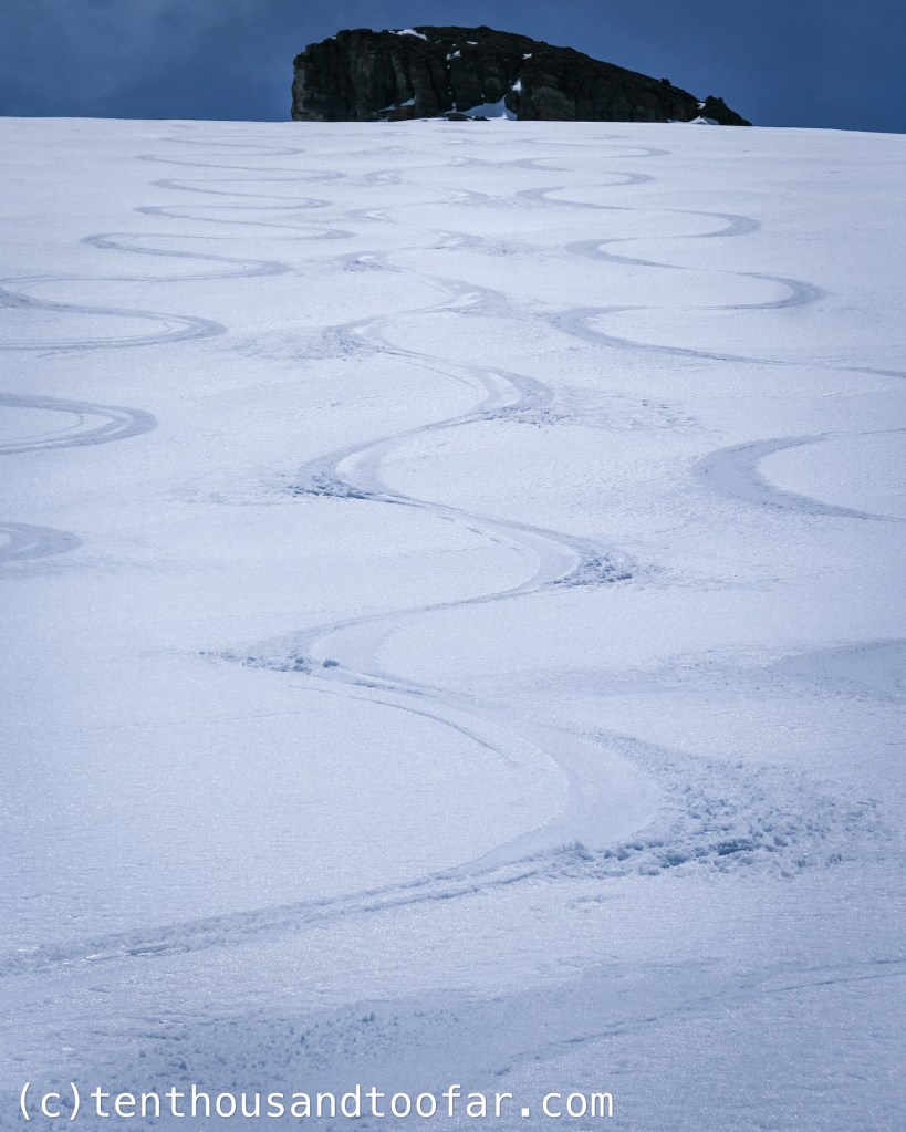
Header Image Description: Perfect corn on the East Face of Mount Bannon, May 31st, 2024

Leave a comment